Geography and Climate in Cappadocia
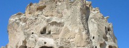
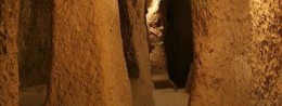
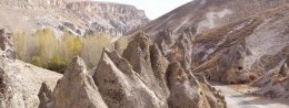
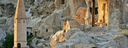
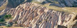
Rating: 9,6/10 (4292 votes) 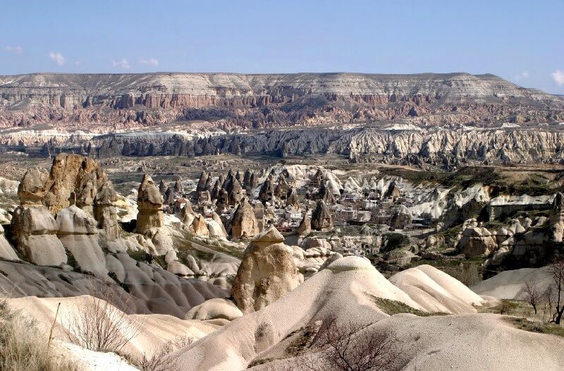 GeographyOne of the most unusual and mysterious places in Turkey is the region under the ancient name Cappadocia. It is located in the eastern part of Asia Minor, in the center of the modern territory of the country. Cappadocia is bordered on different sides by the Cilician Taurus, the Euphrates, the Black Sea and the Galis River. This area can be conventionally represented in the form of a quadrangle, the bases of which are the cities of Kyrshehir, Aksaray, Kayseri and Nigde. At the same time, the center of this quadrangle is the city of Nevsehir. From a geographical point of view, Cappadocia looks like a deserted plateau, stretching at an altitude of 1000 meters above sea level near the Pontine, Taurus and Antitavrian mountains. From the north, the plateau is bordered by the Galis River and the"Phrygian Lake". The largest rivers in Cappadocia are the Galis, Iris (in modern times Yesil-Irmak). The main geographical feature of these places is the quaint stone structures of volcanic origin. There are several ways to get to Cappadocia. There is no direct connection between Russia and central Turkey, therefore, you will first have to make a flight to Istanbul. From there, there are domestic flights to the cities of Nevsehir and Kayseri, which are located in the Cappadocia area. A flight in Turkey will take about an hour. The second way is to get to Ankara by plane, then take a bus to Nevsehir. Drive from there about 280 kilometers along a fairly good road. The time zone of Cappadocia cities: UTC + 2, 1 hour behind Moscow. ClimateCappadocia has a temperate continental climate. Winter is quite cold here, the temperature can drop to 0 ... -15 ° С, but usually it keeps at the level of + 1 ... + 5 ° С. Summers are hot and dry here. During the day at this time of year, the temperature is close to +30 ° С, at night it drops slightly - to + 15 ... + 20 ° С. The driest month is August. Most rainfall occurs in April and May.  We also recommend reading Geography and Climate in Cesky Krumlov Topic: Geography and Climate in Cappadocia. |