Varashev stone description and photo - Russia - Karelia: Pitkyaranta district
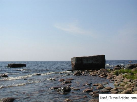
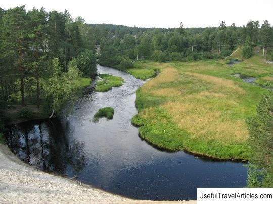
Varashev stone description and photos - Russia - Karelia: Pitkyaranta district. Detailed information about the attraction. Description, photos and a map showing the nearest significant objects. Photo and descriptionVarashev stone is located in the northeastern part of Lake Ladoga on the Varatsky cape near the village of Pograndodushi (35 km south-west of the village). The stone, which is a boundary line between the skerries and rocks of the Northern Ladoga area and the territory of the Olonets Plain, is a huge and massive block of Ladoga pink granite, made in the form of a parallelepiped. This natural border coincides with the formerly ancient ethnic border between the Finno-Ugric tribes - all and Korela. Since 1618, two border marks have marked the international border. The first of them is the Varashev stone, and the second is the border sign in Virtel, which is located on the oldest trade route that runs along the entire shore of Lake Ladoga. According to the peace treaty of Stolbovo, drawn up in 1617, the Russian and Swedish plenipotentiary ambassadors of both countries gathered for the signing on October 25, 1618 on the shores of Lake Ladoga. It was at this place that the demarcation of the border between the Olonetsky pogost, which belonged to the Novgorodsky district, and the Solomensky churchyard, which belonged to the Korelsky district, took place. This is exactly what was written in the Initial Collection of Laws of the Russian Empire. Thus, it was the Varashev stone that served as the source of the border line, which was drawn between Sweden and Russia in accordance with the Stolbovo Treaty. The month and year were carved in the stone as mentioned. A cross in a circle, which is a Russian sign, has survived to this day, but the Swedish crown is most likely simply worn out. According to the conclusions of the hydrograph of the second half of the 19th century A. Andreev, we can say that no evidence was found that a huge mass of granite was laid by man. On the upper and lateral sides of the stone, individual letters and various signs are visible. Most likely, these signs were made for a joke, as they represent a collection of loops, crosses, triangles, circles, i.e. original tags and tags. It is known that this kind of designation could be found in almost any peasant who, not knowing the skills of writing, could designate his various things in this way, denoted by some specific sign. In addition, in this area there is a sufficient amount of fish, which means that there have always been a lot of people here. On holidays or in free time, a large number of hunters stayed here, who could leave tags and tags in memory of their visit. A similar kind of stone is located along the road of the Serdobolsk postal tract, which occupies the place between the village of Olonetsky district, Pogranichnaya Kondusha and the house of the Virdil customs outpost, located in Finland. There is no doubt that this stone is a continuation of the border line, which was determined by the boundary ambassadors back in 1618. The cut of this stone depicts Swedish crowns and letters of the non-Russian alphabet. Although there is some doubt about the designation of the year. The year 1671 is marked on the stone, while the Stolbovsky Treaty was signed in 1617, after the conclusion of which the border line was identified by ambassadors specially designed for this kind of affairs. It can be assumed that a mistake was made. But only the Russian-Swedish border established according to the Stolbovo Treaty remained peaceful for a very short time. In 1654, Russian troops captured the village of Salmi, the center of the border parish, and the next year the Swedes carried out their plan, undertaking a retaliatory campaign against Olonets. As a result, as a result of the Northern War, the territories of the Northern Ladoga area in 1721, which was carried out under the contract of Uusikaupunki. At that moment, the age-old border ceased to exist. At the moment, the Varashev stone is little known, because the road between the shore of Lake Ladoga and the village is in a ruined state, which attracts little foreign tourists. In 1654, Russian troops captured the village of Salmi, the center of the border parish, and the next year the Swedes carried out their plan, undertaking a retaliatory campaign against Olonets.As a result, as a result of the Northern War, the territories of the Northern Ladoga area in 1721, which was carried out under the contract of Uusikaupunki. At that moment, the age-old border ceased to exist. At the moment, the Varashev stone is little known, because the road between the shore of Lake Ladoga and the village is in a ruined state, which attracts little foreign tourists. In 1654, Russian troops captured the village of Salmi, the center of the border parish, and the next year the Swedes carried out their plan, undertaking a retaliatory campaign against Olonets.As a result, as a result of the Northern War, the territories of the Northern Ladoga area in 1721, which was carried out under the contract of Uusikaupunki. At that moment, the age-old border ceased to exist. At the moment, the Varashev stone is little known, because the road between the shore of Lake Ladoga and the village is in a ruined state, which attracts little foreign tourists. the territories of the Northern Ladoga area were officially transferred to Russia in 1721, which was carried out under the Uusikaupunki agreement. At that moment, the age-old border ceased to exist.At the moment, the Varashev stone is little known, because the road between the shore of Lake Ladoga and the village is in a ruined state, which attracts little foreign tourists. The territories of the Northern Ladoga area were officially transferred to Russia in 1721, which was carried out under the Uusikaupunki agreement. At that moment, the age-old border ceased to exist.At the moment, the Varashev stone is little known, because the road between the shore of Lake Ladoga and the village is in a ruined state, which attracts little foreign tourists.     We also recommend reading Catholic Cathedral of God the Merciful Father, description and photo - Ukraine: Zaporozhye Topic: Varashev stone description and photo - Russia - Karelia: Pitkyaranta district. |