Geography and Climate in Trabzon
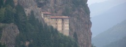
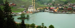
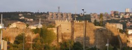
Rating: 7,6/10 (271 votes) 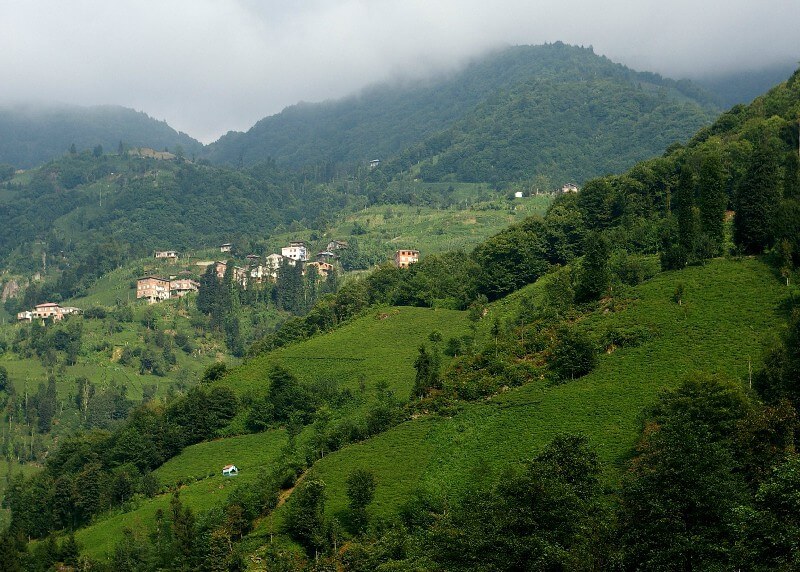 GeographyTrabzon or Trebizond, Trabzon, Trebizond, Trabizun, as it was called at different times by different peoples, appeared 750 years BC. thanks to the Greeks. The city is located in the coastal part of the mainland next to the Black Sea, where the Muchka River begins and a view of the forest-covered mountain Kolat-Dag with a height of almost 3.5 thousand meters opens. Modern Trabzon belongs to Turkey. It is located in the northeastern part of the country and is the capital of Trabzon province. From the south, the city is adjacent to the settlements of Bayburt and Gumushkhane, from the west - Giresun, from the east - Rize, from the north Trabzon is washed by the sea. The most densely populated part of the city is located in the coastal zone. But since Trabzon is located at an altitude of 3 thousand meters above sea level, the mountains and hills are popular with locals and tourists, as is the sea. The city is in a convenient transport location. In any historical period, it was an important center of trade with other countries and in the past was located on the Great Silk Road. And now Trabzon is in demand as a major transport hub, a transit route from the Caucasus to Iran runs through it. You can get to Trabzon by plane. The city has an airport serving flights from Istanbul, Ankara and Izmir. There are no direct flights from Moscow to the city, all of them are carried out via a transfer in Ankara or Istanbul. The flight from Russia will take from four hours. Getting from the airport to the city will not be difficult, it is only 6 km away from the center. Trabzon can be reached from neighboring cities by car. So from Istanbul to the city about 18 hours of travel, there are several flights a day. In addition, it is possible to get to Trabzon from the Caucasus - there are corresponding buses from Tbilisi, the trip will take about 12 hours. The city is also connected to the world by rail and waterways. From Sochi to Trabzon you can take a ferry that follows along the Russian coast. These ferries run twice a week. Travel time - 4.5 hours. Tourists move around the city by buses and dolmus - special route taxis. You can use a taxi service. But it should be remembered that many drivers do not speak English and are not at all averse to making money on tourists. Trabzon time zone: UTC + 2, in summer UTC + 3. It lags behind Moscow by 2 hours. ClimateTrabzon has a mild Black Sea climate, typical of the entire Mediterranean. Winter is relatively calm and humid here, the thermometer usually fluctuates around + 7 ... + 9 ° С. Snow can fall all winter and until March. In summer it is hot in the city, the air usually warms up to + 20 ... + 23 ° С, often up to +30 ° С. The sea remains pretty cool.  We also recommend reading Geography and Climate in Ankara Topic: Geography and Climate in Trabzon. |