Tourist route”Kalendskaya trail””(Crimea)
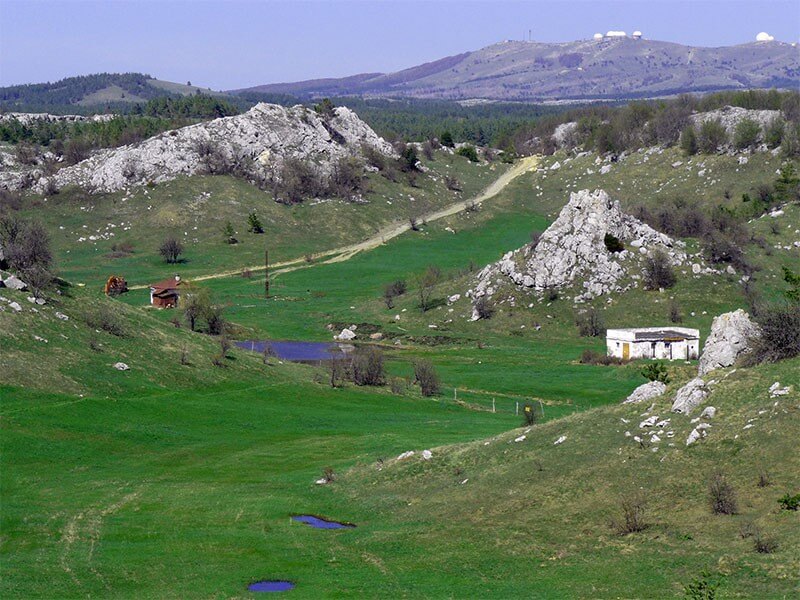
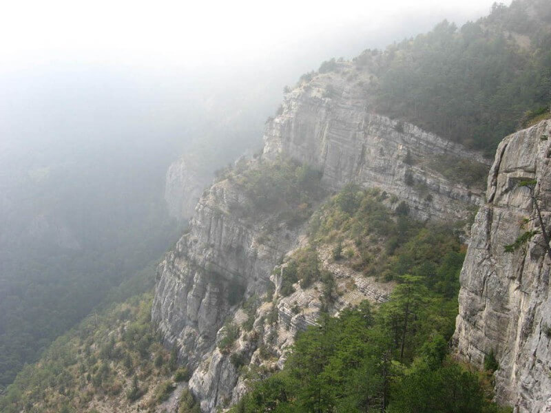
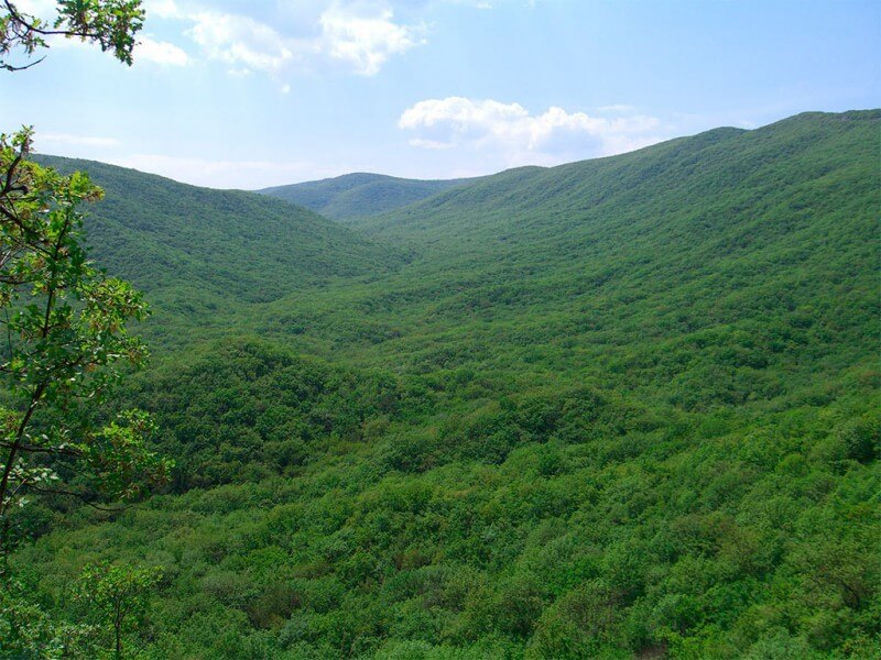
Rating: 8,2/10 (300 votes) 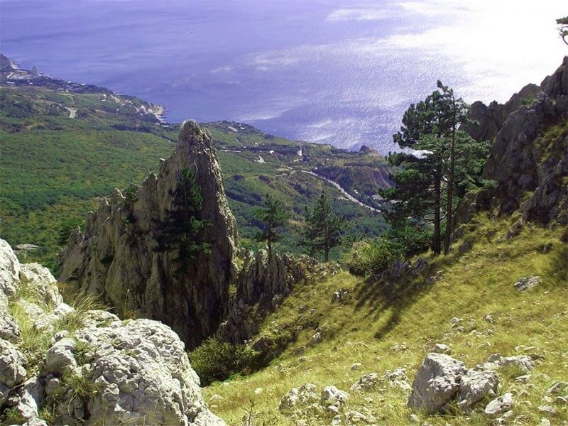 Calendar Trail The uniqueness of the Kalendskaya trail of the Crimea is that it is one of the few practically direct hiking routes on the peninsula. This route differs in many things - in age, unique objects encountered on the way and other things that are better to see live than to rely on the stories of experienced travelers. By right, this road can be called one of the oldest Crimean highways, which is now a visiting card of tourism in the hero city of Sevastopol. History of the routeThe first mention of the road connecting Chersonesos and Kharaks, dates back to Roman documents of the antique period. Even experienced historians do not risk calculating the exact age of the road, therefore the approximate age of about two thousand years is always called. The Romans used this road for the transfer of military units, so it was officially called the"Path of the Soldiers." The name now known appeared much later, but when exactly is the subject of much debate among local historians. Among the most exotic versions, two are most often distinguished, the most plausible. According to the first version, the word"Kalendskaya" was formed from the Turkic expression"Kale-Endy", which can literally be translated as"descending fortress". The second version of the origin of the route name is more plausible. It comes from the meaning of the Latin word"calendar" from which"calendar" is derived. Literally it means"month", but the fact, that the Roman guards in the provinces changed every month, only complements the meaning of this word. Any of the options has the right to exist, and the Calendarsky trail attracts a large number of tourists every year. The passage of this route will be a good alternative to the numerous excursion programs of Sevastopol. Description and durationThe passage of the Kalendskaya trail begins in the village of Podgornoe, which is actually included in one of the Sevastopol districts. Already at the start, tourists can expect an unpleasant surprise - the path has many forks, but it is very difficult to get out on that very “Roman road” for the first time. In fact, the approach to the road begins at the very entrance to Podgornoye. The main thing is not to choose the left fork, so as not to run into a dead end. The dirt road should lead the tourist group to the Calende River, and the road itself will pass along its right bank.  Kalenda River After passing the open section along the river bank, the trail will begin to twist and lead the group into a not too dense forest. You do not need to be afraid, the main thing is to stick to the visible road so as not to get lost in a large enough forest area. After passing through the forest, a gentle ascent will begin, and the road will practically stop winding. Two mountain ranges will become a good reference point for travelers. If you go from the village of Podgorny, then on the left hand will be Mount Khazandzhik, and on the right hand is Mount Kalenda-Bair. Both peaks are almost opposite each other, and the trail runs exactly between them.  Mount Khazandzhik Leaving two peaks behind, tourists will see a fork - of the three roads, you need to choose the middle one. The other two lead into a dense forest through thickets of thorns, which few people want to get into. The next point of the route will be Mount Anakhly-Bel. If the correct path was chosen, then it will not be difficult to see the hill. The destination of this section of the route is the famous Devil's Staircase, which begins just behind the pass.  The Devil's Ladder Despite the threatening name, the stairs cannot be called a dangerous section of the route. You will have to go down it, not go up, and the exit to the descent is indicated by arrows, which knocked out past generations of tourists. Descent along the Ladder will take no more than 10 minutes, after which the final section of the path begins. You can choose a route for the last dash from several options. The safest and at the same time the most picturesque path is the serpentine road, which starts on the right side of the exit from the Devil's Staircase. After passing along the serpentine, tourists come out onto a well-run dirt road that leads to a small village Oliva. From this village you will need to walk about 200 meters to the bus stop, which is located on a branch of the Yalta-Sevastopol highway. Both cities can be reached without any difficulty. The waiting time for the bus rarely exceeds half an hour. From Oliva, the passage of the Calendar trail can be considered successfully completed. Interesting factsThroughout the route, you will come across the so-called"abandoned plots »roads. Guides and all kinds of guidebooks will stubbornly call them abandoned, but these are quite lively areas in terms of tourism. The Kalendskaya trail is one of the few Crimean hiking trails suitable for passing not only in summer, but also in winter. The rest of the hiking trails suffer to varying degrees from the winter showers and snows of the Crimea, so it is very frivolous to consider them safe for passing. The good condition of the Kalendsky trail is also due to historical realities. It passes through the Baydar Valley, which had a special status during the existence of the Crimean Khanate. Its residents were exempted from paying taxes, but in return they had to monitor the road and keep it in excellent condition.  Baydar Valley Not far from the trail behind the Khergiani Rock there is a local landmark - a monument to the Crimean partisans. The mass grave is looked after, every month you can see fresh flowers here. We also recommend reading Things to do in Vietnam Topic: Tourist route”Kalendskaya trail””(Crimea). |