Sunny (Tsar's) trail description and photo - Crimea: Gaspra
Rating: 8,7/10 (789 votes) 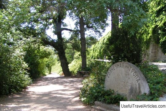
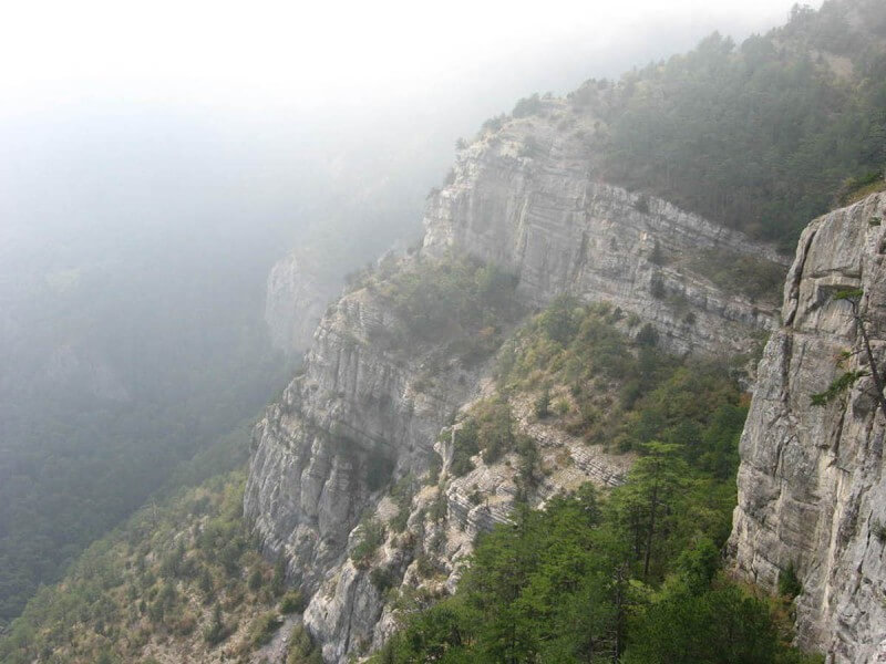
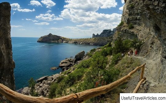
Sunny (Tsar's) trail description and photos - Crimea: Gaspra. Detailed information about the attraction. Description, photos and a map showing the nearest significant objects. Photo and descriptionThe famous path between Gaspra and Livadia park is called the Tsar's or the Sun path. Once upon a time, members of the royal family walked along it, hence the name came from. Its second name is Solnechnaya, its height is 130-140 meters above sea level. The trail is very comfortable for walking, there are no difficult ascents and descents on it. The length of the trail is six kilometers seven hundred meters, it is quite easy to walk them. Unusual plants and interesting sculptures are located along the entire trail. There are benches for relaxing in the shade of ancient oak trees. Even in the most intense heat, coolness reigns here. Walking the trail is good for your health. Climatic and natural healing factors act on the body of those walking. Therefore, sometimes the path is also called the road of health. This trail was first discovered in 1843. She then occupied a site only under the Lower Oreanda. When the royal family acquired the Livadian estate from Count Potocki, the trail began to connect Oreanda with Livadia in 1861. The trail has several excellent viewing platforms. They offer magnificent views of the beauty of the South Coast. The beginning of the trail is Lower Oreanda, and it is in this area that the most impressive sites are located. The trail is crossed by many small paths that lead to nearby sanatoriums and to public transport stops. It will take two hours to walk the trail from start to finish at a slow pace. The trail goes to the Livadia Palace. Here is a diagram of the entire route, and right there the famous sundial is installed, the time on which is not very accurate. Along the entire trail there are signs-signs, where it is written how many kilometers traveled and how many are still left, as well as the height above sea level. The end of the trail is in Upper Miskhor. Nicholas II, walking with Alexander Mikhailovich, the Grand Duke, saw the trail for the first time. And then he ordered to arrange it from Livadia to the Ai-Todor estate. The trail was built and, despite the mountainous terrain in these places, we avoided sharp drops. The Emperor loved to walk, he liked his brother's project. Shortly before returning to St. Petersburg, he gave the order to lengthen the path: to lead from Ai-Todor to the Rose Gate. By 1901, the trail was completed, and the royal family began to take regular walks along it, either on horseback or on foot. Paths were arranged to the trail - descents to the estates of the emperor's brothers - "Kharaks" and "Chairu".        We also recommend reading Palace of the Vice-Administrator description and photo - Belarus: Grodno Topic: Sunny (Tsar's) trail description and photo - Crimea: Gaspra. |