National Park Paklenica (Nacionalni park Paklenica) description and photos - Croatia: Zadar
Rating: 8,1/10 (132 votes) 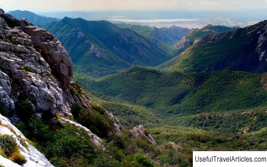
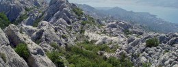
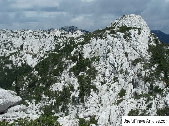
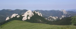
Paklenica National Park (Nacionalni park Paklenica) description and photos - Croatia: Zadar. Detailed information about the attraction. Description, photographs and a map showing the nearest significant objects. The name in English is Nacionalni park Paklenica. Photo and descriptionPaklenica National Park is located 46 kilometers north of Zadar. It is located in the southern part of the Velebit Mountains. It is here that the highest mountain point in Croatia is located. The Velebit Ridge starts from the very Adriatic coast. The massif is about 145 kilometers long and about 25 kilometers wide. The peak of the ridge, which is the highest point in the whole of Croatia, is Mount Vaganski, its height reaches about 1758 meters. Paklenica Park can be divided into two parts: Big and Small Paklenica. The length of the first is about 14 kilometers, the second - 12. Both canyons of bizarre shape are part of the Velebit mountains. There are a lot of deepest gorges (up to 400 meters) in the park, they appeared as a result of long-standing geological processes and erosion. The park is rich in a variety of fauna and flora. On its territory, there are quite rare species of reptiles, birds and insects. Local climbers have chosen the Anich Kuk rock, reaching a height of 437 meters. In general, there are a lot of tourist routes in the park that can be interesting for both experienced climbers and beginners. Tourists will also be interested in visiting the local Manita Pech cave, which is located a kilometer from Anich Kuk. The tourists are accompanied by experienced guides who know a lot about the history of these places. The depth of the cave reaches about 500 meters, but for safety reasons, tourists only have access to a plot of 175 meters. In general, there are about 70 caves on the territory of Paklenice. After the political conflict between Tito and Stalin in 1949, a bunker was built on the territory of the park; it is located at a depth of 250 meters under one of the Velebit hills. Now the bunker is being rebuilt and they want to make it a museum object. One of the projects for the reconstruction of the bunker is to convert it into an art gallery. Another natural attraction of the park is the Zrmanja River, which flows in the southeast of the park.     We also recommend reading Skala Sykamnias description and photos - Greece: Lesvos Island Topic: National Park Paklenica (Nacionalni park Paklenica) description and photos - Croatia: Zadar. |