River Kutsajoki description and photos - Russia - North-West: Murmansk region
Rating: 8,3/10 (5465 votes) 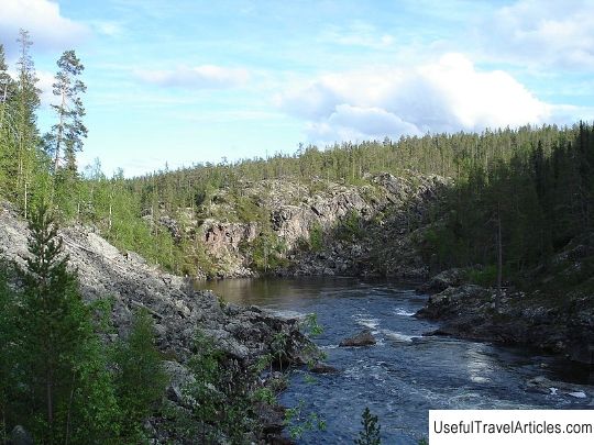
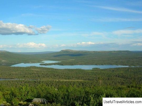
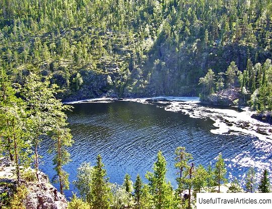
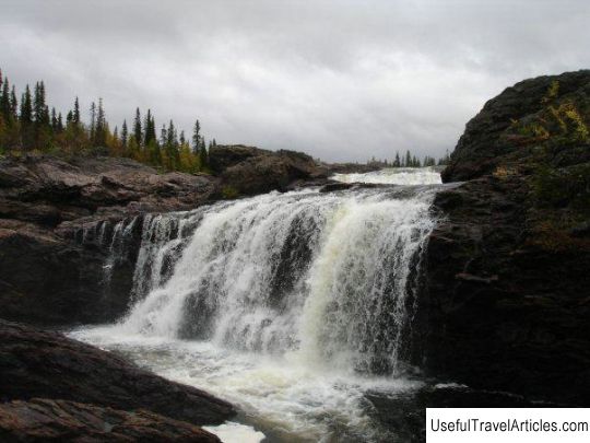
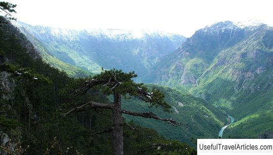
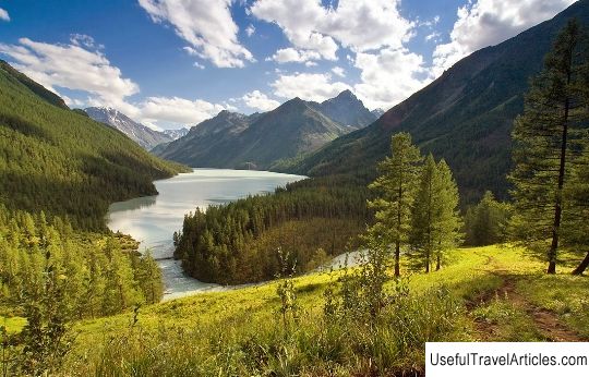
Kutsayoki river description and photos - Russia - Northwest: Murmansk region. Detailed information about the attraction. Description, photos and a map showing the nearest significant objects. Photo and descriptionThe Kutsayoki River is located in the south-west of the Murmansk region of the Russian Federation. It flows in an uninhabited area near the Russian-Finnish border. The length of the river is measured at 44 kilometers. In some places the maximum depth is 6 meters. The river bottom is mostly sandy and rocky. The shores are mostly sandy-sandy loam, but in places they are stone with gravel and boulders, 1 - 4 meters high, 10-30 degrees steep. There are cliffs up to 30 meters. Floodplains are swampy in places, intermittent. The Kutsajoki River originates from Lake Nivjarvi, where the two rivers Ontonjoki and Vuosnajoki meet. It itself merges with the Tuntsajoki River, thereby forming the Tumcha River. The closest settlements to the river are the village of Alakurtti and the uninhabited village of Vuorijarvi. The river has a large number of rapids and shivers, which are formed by rocky outcrops. It also has two large waterfalls. Small Yaniskengas waterfall reaches a height of about 8-10 meters. In tourist guides and reports it is called "Oba-na". For water tourism, the waterfall is considered passable, but in terms of the difficulty of passing it belongs to the 6th category. However, this waterfall has an additional danger, the fact is that from the influx it is completely inaudible and visually barely noticeable. Big Yaniskengas is the name of the second waterfall on the Kutsajoki River. The tilt angle is approximately 70-80 degrees. The height is almost 20 meters. The waterfall has 3 steps. The first is almost 7 meters, the second is about 12 meters, the third is about 1.5 m. It is called "Mamanya" in tourist guides. This waterfall is extremely dangerous and difficult to pass, but daredevils do not give up trying. There are five known cases of successful development of the waterfall by kayakers. The waterfall has an additional danger, like the previous waterfall, from the influx it is not audible and is almost invisible visually. In spite of everything, the river is very popular among water tourists. It is worth noting that the waterfalls are very picturesque and adorn the route. In addition to these waterfalls, there are interesting and complex rapids on the river, among which the following can be noted: "Close", "Doubtful", "Waterfall" and "Stupenka ". In November, or rather in the first half, the Kutsajoki river freezes up and opens up in mid-May. At the end of winter, the ice thickness is 0.7-1 m. However, not the entire river freezes, the rapids remain untouched. During the flood, which usually occurs in the second half of May and the first half of June, the water level in the river increases by 2-3 meters. The dry season starts from the end of July and lasts until September. During summer rains, the water level in Kutsajoki can rise by 1 meter. The Kutsajoki River is not navigable, the water supply is replenished by snow and rain. The vegetation along the banks is standard taiga: birch, pine, spruce. Berries - lingonberry, cloudberry, blueberry, blueberry (sometimes they do not have time to ripen during the summer period). Mushrooms - boletus, russula, porcini, aspen, etc. Fish, mainly grayling, trout, perch, pike, roach, comes across trout. There are many birds - geese, black grouse, ducks, you can meet swans and cranes. Large animals are bear and elk. The climate of the area, due to its location at the Arctic Circle, especially at the beginning of summer, unpleasant, characterized by abrupt weather changes. However, the combination of high mountains, tight canyons, powerful and picturesque rapids with an abundance of mushrooms and berries, as well as good fishing, is a good incentive for tourists. And the name of the river itself speaks for itself, because in translation Kutsayoki means "calling river".      We also recommend reading Church of Simeon the Stylite on Povarskaya description and photo - Russia - Moscow: Moscow Topic: River Kutsajoki description and photos - Russia - North-West: Murmansk region. |