Mount Arayat description and photos - Philippines: Luzon Island
Rating: 7,5/10 (100 votes) 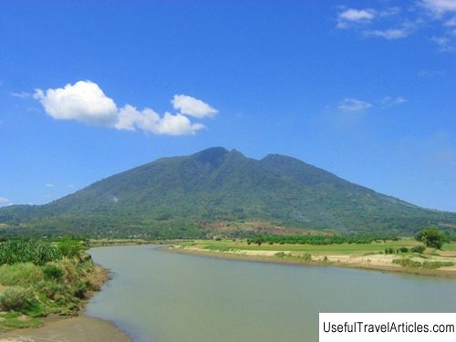
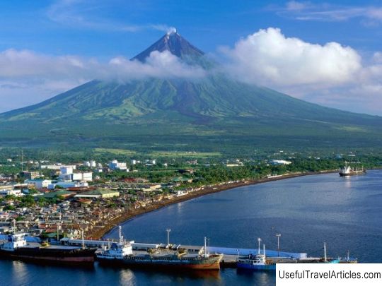
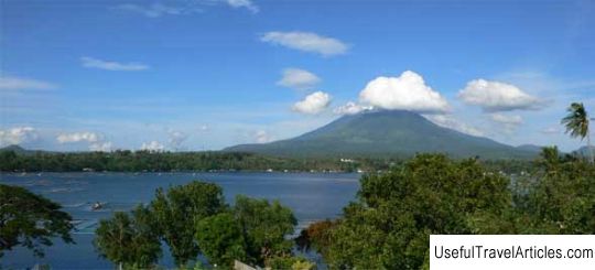
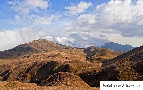
Mount Arayat description and photos - Philippines: Luzon Island. Detailed information about the attraction. Description, photographs and a map showing the nearest significant objects. The name in English is Mount Arayat. Photo and descriptionMount Arayat is a potentially active volcano located on the Philippine island of Luzon. Its height is 1026 meters. So far, not a single eruption has been recorded. Arayat is considered a mystical mountain, the habitat of the legendary wizard Aring Sinukuan or, as he is also called, Mariang Sinukuan. The volcano is located in an agricultural region - in the heart of the plains of Central Luzon. The southern part of the mountain is included in the Arayat municipality of Pampanga province, the northern part is in the Magalang municipality of the same province. 10 miles west is the city of Angeles City and the former US military base Clark. There is also an active volcano Pinatubo, the last eruption of which occurred in 1991. At the very top of the mountain, you can see a round volcanic crater about 1.2 km in diameter. True, most of it in the western and northern parts has collapsed as a result of erosion. Although there is no record of Arayat eruptions, small jets of steam sometimes erupt to the surface from the most eroded parts of the crater on the northwest side. It is believed that one of the ancient volcanic eruptions formed the Lava Dome on the western slopes of the mountain. Today it is one of the main tourist attractions in Arayat and a field practice site for students of the Pampanga Agricultural College. There are two paths leading to the top of the mountain. One starts in Mount Arayat National Park and leads to the South Peak - the road takes 3-4 hours. It offers views of Central Luzon and the Pampanga River Valley. To the west are the Zambales mountains, and in the east is the Sierra Madre ridge. The northern, higher Peak can be reached from the town of Magalang - the road will also take 3-4 hours. This trail passes through the rock formation Arayata Amphitheater and the Lava Dome - home of the legendary Aring Sinukuan. The word "Sinuquan" in the language of local tribes means "the end" or "the one to whom others have obeyed." According to legend, in ancient times, Mount Arayat was located in the middle of a swamp, and because of this, its inhabitants always suffered. And only Sinukuan was able to move the mountain and save its inhabitants from disasters. The wizard was very powerful - his only rival was the wizard Namalyari from Mount Pinatubo. It is said that the Ayala Falls near the town of Magalang served as a "bath" for Sinukuan - today they are often visited by tourists and locals. And he lived in the same Lava Dome with its shimmering vaults. It is believed that the wizard must return to respond to the Namalari "attack", as the locals interpret the 1991 Pinatubo eruption. According to another version, Shinukuan will return when the time comes for the last battle before the end of the world.  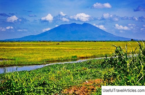    We also recommend reading Theater ”Litsedei” description and photos - Russia - St. Petersburg: St. Petersburg Topic: Mount Arayat description and photos - Philippines: Luzon Island. |