Mount Banahaw description and photos - Philippines: Luzon Island
Rating: 8,2/10 (1545 votes) 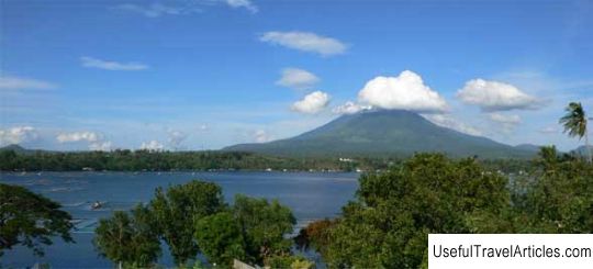
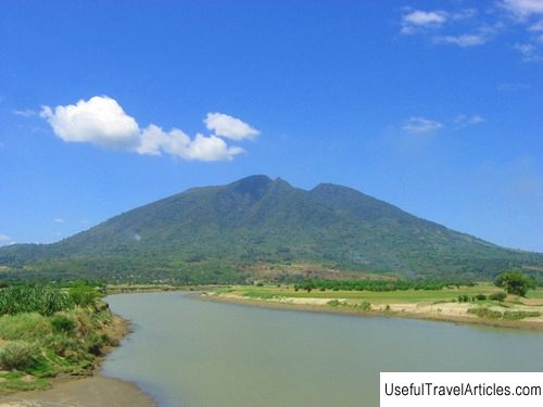
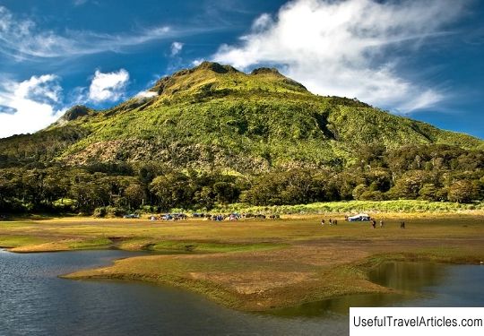
Mount Banahaw description and photos - Philippines: Luzon Island. Detailed information about the attraction. Description, photographs and a map showing the nearest significant objects. The name in English is Mount Banahaw. Photo and DescriptionMount Banachau, also known as Banahao, is an active volcano located on the Philippine island of Luzon on the border of the Laguna and Quezon regions. The height of the Banachau volcano is 2158 meters, and the crater at its top has dimensions of 1.5 * 3.5 km and 210 meters deep. Nearby are the volcanoes San Cristobal, Mayabobo, Masalakot Doms and Banachau de Lukban. The word "banachau" itself has to do with shrines, it is close to the Tagalog word "banal", which means "holy, sacred, divine." According to linguists, "Banachau" can mean "supposedly a holy place." And local tribes consider the mountain and its surroundings a special place because of the "holy water" - numerous hot springs, which, in their opinion, have healing properties. In addition, there are many “holy places” that are also considered sacred - these are various natural attractions, such as rocks, caves and springs, in which original altars are built. These places were discovered during the Spanish colonization. Today, there is a continuous stream of pilgrims from the local population to Mount Banachau, who hope to find health and well-being here. In addition, the mountain is popular with climbers and rock climbers who are attracted by its height. This, by the way, is the closest mountain to Manila, with a height of more than 2 thousand meters. During Holy Week, the number of visitors is several thousand. There are at least 4 trails leading to the summit from Dolores, Sariya and other settlements in the province of Quezon. On average, the way to the top takes from 5 to 9 hours. In addition to viewing platforms located on the top of Banachau, tourists are attracted by the Cave of God the Father and a spring near the town of Kinabahayan, which is rumored to have healing powers.   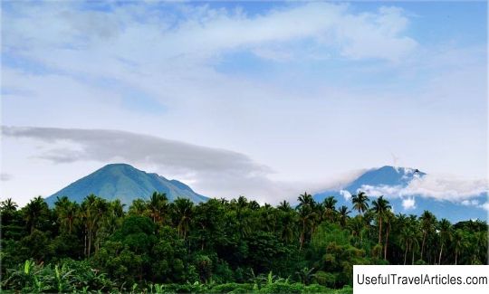      We also recommend reading Amethist mine description and photos - Finland: Pyha - Luosto Topic: Mount Banahaw description and photos - Philippines: Luzon Island. |