Pinatubo volcano description and photos - Philippines: Luzon Island
Rating: 9,7/10 (6765 votes) 
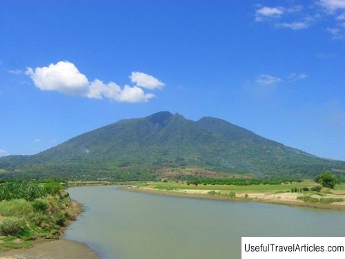
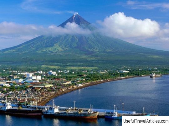
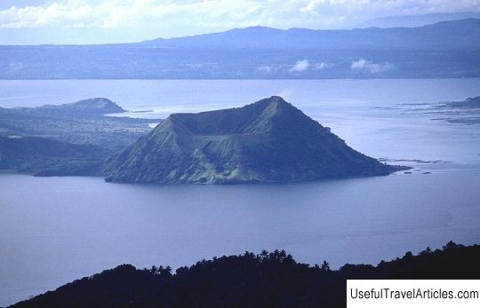
Pinatubo volcano description and photos - Philippines: Luzon Island. Detailed information about the attraction. Description, photographs and a map showing the nearest significant objects. The title in English is Pinatubo. Photo and descriptionPinatubo Volcano is an active volcano located on Luzon Island, 87 km from Manila. The last time the volcano erupted was in 1991, although before that it was considered extinct, since it "slept" for over 600 years. Before the eruption, its height was 1745 meters, and today it is 1486 meters. In the 16th century, when the Spanish conquistadors appeared in Luzon, the Pinatubo covered in dense forest was a refuge for the hiding natives of the Aeta tribe. In April 1991, scientists noticed the first signs of the approaching eruption of Pinatubo - after tremors, a column of steam appeared above the top of the volcano. Residents of all cities and towns located within a radius of 20 km were immediately evacuated. The first explosion occurred on June 12, raising a black ash cloud to a height of 19 km. Next explosion more powerful, occurred 14 hours later. The largest eruption happened on June 15 - the wave height was 34 km, and the ejected ash covered an area of the sky with an area of 125 thousand square kilometers! The territory on this square plunged into darkness for several hours. Subsequently, weaker eruptions took place until June 17. As a result, about 900 people were killed, and the Clark US Air Force Base and the US Naval Base were destroyed. The eruption was recognized as one of the strongest in the 20th century - it received 6 points on the Richter scale. Interesting fact: Former President of the Philippines Ramon Magsaysay, a native of the province of Zambales, named his private jet "Pinatubo". In 1957, the plane crashed, which killed 25 people, including President Magsaysay himself. Over the past 20 years, tremors have regularly occurred in the Pinatubo area, making construction impossible here. Scientists believe that the volcano will still show its temper, and the eruption could be much stronger than in 1991. However, today the Pinatubo volcano is one of the most popular mountain tourism sites in the Philippines. Numerous tours are organized here, during which you can go on a raft on the crater lake and raft. In the vicinity of the volcano there is a village of Aeta, which is of ethnographic interest. And in the town of Kapas, on the way to Pinatubo, you can visit the National Monument dedicated to the infamous Death March. There was a camp in which the Japanese during the Second World War held thousands of American and Filipino prisoners of war, captured after the Battle of Bataan. In this camp, 2,200 American and 27,000 Filipino soldiers died. The memorial consists of a park with an area of 54 hectares, part of which is planted with trees according to the number of deaths. In 2003, an obelisk 70 meters high was erected in the park, surrounded by a black marble wall with the names of the buried military.        We also recommend reading Holy Trinity Michael-Klopsky monastery description and photos - Russia - North-West: Novgorod region Topic: Pinatubo volcano description and photos - Philippines: Luzon Island. |