Hochfeiler mountain description and photos - Austria: Zillertal
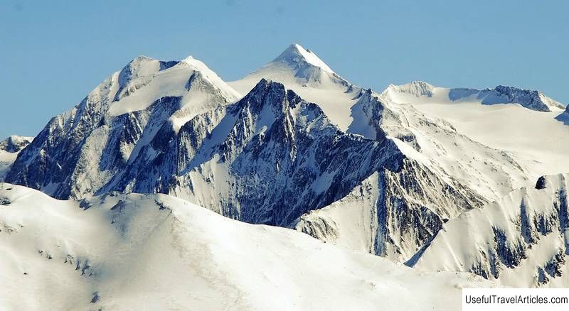
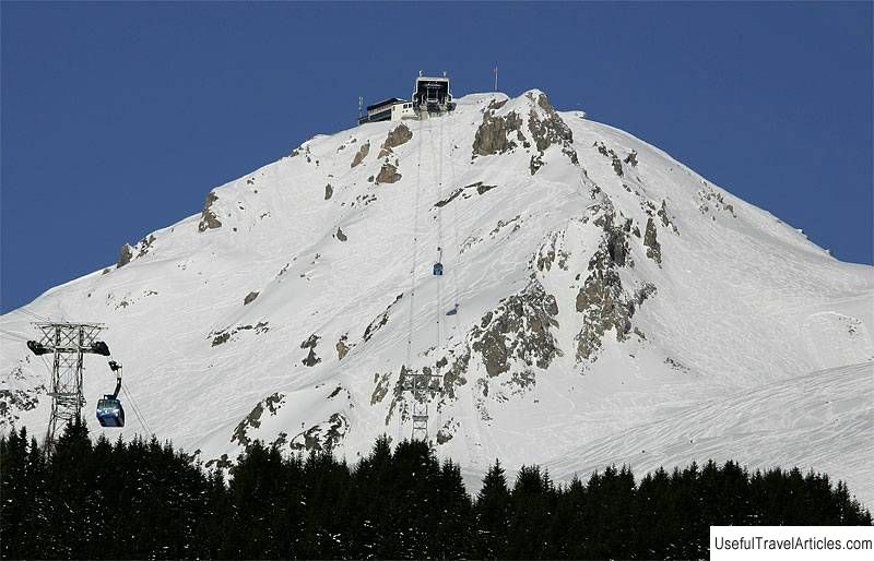
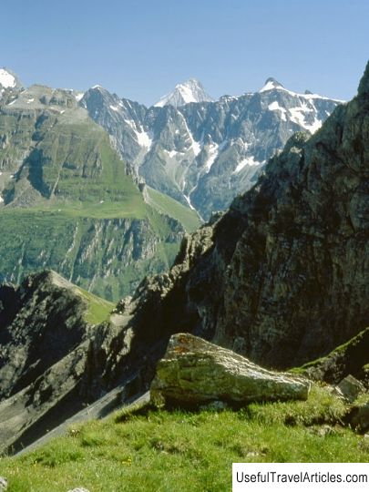
Hochfeiler mountain description and photos - Austria: Zillertal. Detailed information about the attraction. Description, photographs and a map showing the nearest significant objects. The title in English is Hochfeiler. Photo and descriptionHochfeiler is the highest mountain in the Zillertal Alps. Its height is 3509 meters above sea level. It is located on the border between Austria and Italy. On the Austrian side, the slopes of the Hochfeiler are inaccessible, steep ice cliffs that look very impressive from the Schlegespeicher lake. From the Italian South Tyrol side, the mountain is accessible for climbing. Experienced climbers will be able to climb it, and they will spend no more than one day on the climb. The first ascent to the top of Hochfeiler was made on June 24, 1865 by Paul Grohmann with his guides Georg Samer and Peter Fuchs. It is along their route (on a slope facing Italy) that everyone now climbs Mount Hochfeiler. A convenient road leads to the southwestern peak of Hochfeiler. Another exciting one but a much less popular route, which requires a high level of skill, is from the northeastern ice wall. Climbers who are not looking for easy ways can also climb to the top of the mountain along the northwestern, almost steep slope. The easiest way to the top starts from an alpine hut, which is located at an altitude of 2710 meters. It can be reached by car from the Pfitscher Tal. The best period for hiking is considered to be August - early September, when there are few areas covered with snow and there is no need to climb over ice-covered rocks. It is useful to equip yourself with an ice ax and a rope, although they may not be needed when climbing. A gorgeous panorama of the Dolomites and the Central Alps opens from the top of Hochfeiler. the passage through which requires a high level of skill is laid from the side of the northeastern ice wall. Climbers who are not looking for easy ways can also climb to the top of the mountain along the north-western, almost steep slope.The easiest way to the top starts from an alpine hut, which is located at an altitude of 2710 meters. It can be reached by car from the Pfitscher Tal. The best period for hiking is considered to be August - early September, when there are few areas covered with snow and there is no need to climb over ice-covered rocks. It is useful to equip yourself with an ice ax and a rope, although they may not be needed when climbing. A gorgeous panorama of the Dolomites and the Central Alps opens from the top of Hochfeiler. the passage through which requires a high level of skill is laid from the side of the northeastern ice wall. Climbers who are not looking for easy ways can also climb to the top of the mountain along the northwestern, almost steep slope.The easiest way to the top starts from an alpine hut, which is located at an altitude of 2710 meters. It can be reached by car from the Pfitscher Tal. The best period for hiking is considered to be August - early September, when there are few areas covered with snow and there is no need to climb over ice-covered rocks. It is useful to equip yourself with an ice ax and a rope, although they may not be needed when climbing. A gorgeous panorama of the Dolomites and the Central Alps opens from the top of Hochfeiler. not looking for easy ways, they can also climb to the top of the mountain along the north-western, almost steep slope.The easiest way to the top starts from an alpine hut, which is located at an altitude of 2710 meters. It can be reached by car from the Pfitscher Tal. The best period for hiking is considered to be August - early September, when there are few areas covered with snow and there is no need to climb over ice-covered rocks. It is useful to equip yourself with an ice ax and a rope, although they may not be needed when climbing. A gorgeous panorama of the Dolomites and the Central Alps opens from the top of Hochfeiler. not looking for easy ways, they can also climb to the top of the mountain along the northwestern, almost steep slope.The easiest way to the top starts from an alpine hut, which is located at an altitude of 2710 meters. It can be reached by car from the Pfitscher Tal. The best period for hiking is considered to be August - early September, when there are few areas covered with snow and there is no need to climb over ice-covered rocks. It is useful to equip yourself with an ice ax and a rope, although they may not be needed when climbing. A gorgeous panorama of the Dolomites and the Central Alps opens from the top of Hochfeiler. which is located at an altitude of 2710 meters. It can be reached by car from the Pfitscher Tal. The best period for hiking is considered to be August - early September, when there are few areas covered with snow and there is no need to climb over ice-covered rocks. It is useful to equip yourself with an ice ax and a rope, although they may not be needed when climbing. A gorgeous panorama of the Dolomites and the Central Alps opens from the top of Hochfeiler. which is located at an altitude of 2710 meters. It can be reached by car from the Pfitscher Tal. The best period for hiking is considered to be August - early September, when there are few areas covered with snow and there is no need to climb over ice-covered rocks. It is useful to equip yourself with an ice ax and a rope, although they may not be needed when climbing. A gorgeous panorama of the Dolomites and the Central Alps opens from the top of Hochfeiler. A gorgeous panorama of the Dolomites and the Central Alps opens from the top of Hochfeiler. A gorgeous panorama of the Dolomites and the Central Alps opens from the top of Hochfeiler.    We also recommend reading Norsk Kjoretoyhistorisk Museum description and photos - Norway: Lillehammer Topic: Hochfeiler mountain description and photos - Austria: Zillertal. |