Mount Binga (Monte Binga) description and photos - Mozambique
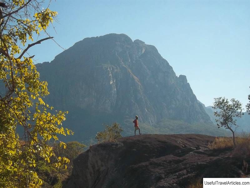
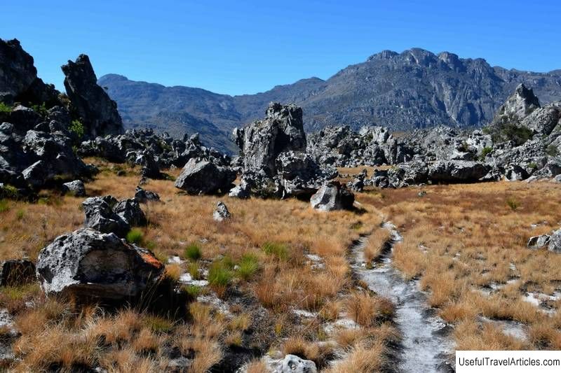
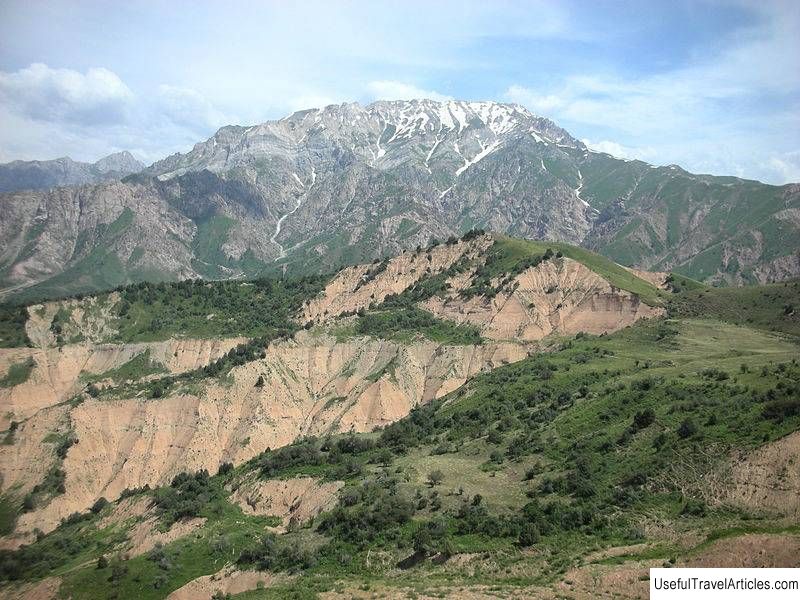
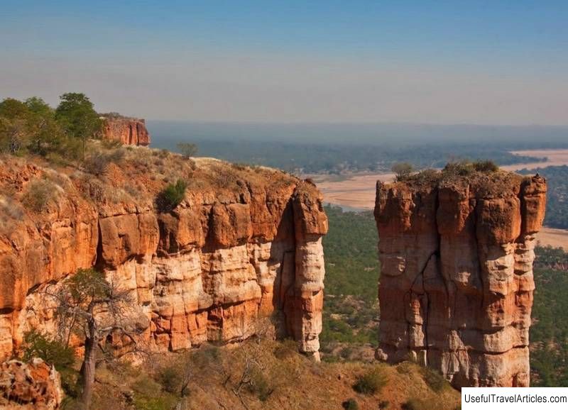
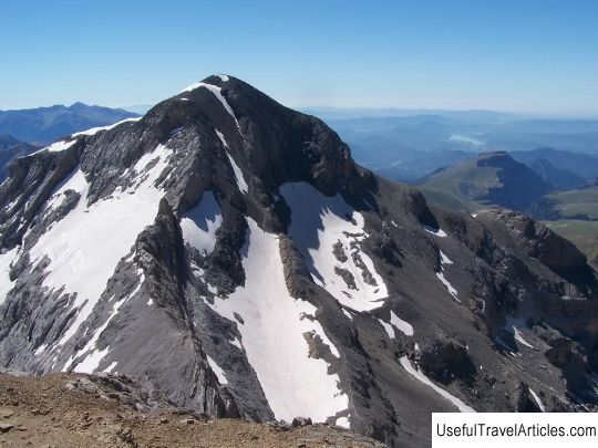
Monte Binga description and photo - Mozambique. Detailed information about the attraction. Description, photographs and a map showing the nearest significant objects. The name in English is Monte Binga. Photo and descriptionMount Binga is located in the Chimanimani National Park, which is located on the border of two countries - Mozambique and Zimbabwe. It rises 2436 meters above sea level and is considered the highest peak in Mozambique. Climbing Bingu requires good physical fitness and mountaineering experience. It is important to note that even minor injuries sustained during the assault on this summit can be life-threatening, since the nearest hospital is located 100 km northeast of the mountain in Chimoio, and it will be very difficult to quickly reach it in an emergency. Chimanimani National Park also lacks shops selling food and equipment that might be required to climb Bingu. The best time to climb the mountain is from April to October. The easiest way to climb Binga is from the eastern, more gentle slope of the mountain. The western side has steep ledges, however, there is an old smugglers' trail. The northern slope, closer to the top, drops vertically downward. The ascent takes most of the day. The path, beaten by many climbers, is marked by cairns. Small pools of water are often found on the eastern slope. The mountain peak seems gloomy and inhospitable. In the upper part of Binga peak, the rocks are covered with a thin layer of peat, on which only moss and low blades grow. The ascent to the top of Binga is worth all the difficulties, because from above there is a magnificent view of the plain. In theory, if you equip yourself with a telescope, on a clear day, the Indian Ocean will be visible from the mountain. The easiest way to climb Binga is from the eastern, more gentle slope of the mountain. The western side has steep ledges, however, there is an old smugglers' trail. The northern slope, closer to the top, drops vertically downward.The ascent takes most of the day. The path, beaten by many climbers, is marked by cairns. Small pools of water are often found on the eastern slope. The mountain peak seems gloomy and inhospitable. In the upper part of Binga peak, the rocks are covered with a thin layer of peat, on which only moss and low blades grow. The ascent to the top of Binga is worth all the difficulties, because from above there is a magnificent view of the plain. In theory, if you equip yourself with a telescope, on a clear day, the Indian Ocean will be visible from the mountain. The easiest way to climb Binga is from the eastern, more gentle slope of the mountain. The western side has steep ledges, however, there is an old smugglers' trail. The northern slope, closer to the top, drops vertically downward.The ascent takes most of the day. The path, beaten by many climbers, is marked by cairns. Small pools of water are often found on the eastern slope. The mountain peak seems gloomy and inhospitable. In the upper part of Binga peak, the rocks are covered with a thin layer of peat, on which only moss and low blades grow. The ascent to the top of Binga is worth all the difficulties, because from above there is a magnificent view of the plain. In theory, if you equip yourself with a telescope, on a clear day, the Indian Ocean will be visible from the mountain. more gentle slope of the mountain. The western side has steep ledges, however, there is an old smuggler's trail. The northern slope, closer to the top, drops vertically downward.The ascent takes most of the day. The path, beaten by many climbers, is marked by cairns. Small pools of water are often found on the eastern slope. The mountain peak seems gloomy and inhospitable. In the upper part of Binga peak, the rocks are covered with a thin layer of peat, on which only moss and low blades grow. The ascent to the top of Binga is worth all the difficulties, because from above there is a magnificent view of the plain. In theory, if you equip yourself with a telescope, on a clear day, the Indian Ocean will be visible from the mountain. more gentle slope of the mountain. The western side has steep ledges, however, there is an old smugglers' trail. The northern slope, closer to the top, drops vertically downward.The ascent takes most of the day. The path, beaten by many climbers, is marked by cairns. Small pools of water are often found on the eastern slope. The mountain peak seems gloomy and inhospitable. In the upper part of Binga peak, the rocks are covered with a thin layer of peat, on which only moss and low blades grow. The ascent to the top of Binga is worth all the difficulties, because from above there is a magnificent view of the plain. In theory, if you equip yourself with a telescope, on a clear day, the Indian Ocean will be visible from the mountain. there is an old smugglers' trail. The northern slope, closer to the top, drops vertically downward.The ascent takes most of the day. The path, beaten by many climbers, is marked by cairns. Small pools of water are often found on the eastern slope. The mountain peak seems gloomy and inhospitable. In the upper part of Binga peak, the rocks are covered with a thin layer of peat, on which only moss and low blades grow. The ascent to the top of Binga is worth all the difficulties, because from above there is a magnificent view of the plain. In theory, if you equip yourself with a telescope, on a clear day, the Indian Ocean will be visible from the mountain. there is an old smugglers' trail. The northern slope, closer to the top, drops vertically downward.The ascent takes most of the day. The path, beaten by many climbers, is marked by cairns. Small pools of water are often found on the eastern slope. The mountain peak seems gloomy and inhospitable. In the upper part of Binga peak, the rocks are covered with a thin layer of peat, on which only moss and low blades grow. The ascent to the top of Binga is worth all the difficulties, because from above there is a magnificent view of the plain. In theory, if you equip yourself with a telescope, on a clear day, the Indian Ocean will be visible from the mountain. marked with cairns. Small pools of water are often found on the eastern slope. The mountain peak seems gloomy and inhospitable. In the upper part of Binga peak, the rocks are covered with a thin layer of peat, on which only moss and low blades grow.The ascent to the top of Binga is worth all the difficulties, because from above there is a magnificent view of the plain. In theory, if you equip yourself with a telescope, on a clear day, the Indian Ocean will be visible from the mountain. marked with cairns. Small pools of water are often found on the eastern slope. The mountain peak seems gloomy and inhospitable. In the upper part of Binga peak, the rocks are covered with a thin layer of peat, on which only moss and low blades grow.The ascent to the top of Binga is worth all the difficulties, because from above there is a magnificent view of the plain. In theory, if you equip yourself with a telescope, on a clear day, the Indian Ocean will be visible from the mountain.     We also recommend reading Latvian National History Museum (Latvijas Nacionalais vestures muzejs) description and photo - Latvia: Riga Topic: Mount Binga (Monte Binga) description and photos - Mozambique. |