Aqueduct Kamares description and photos - Cyprus: Larnaca
Rating: 8,3/10 (342 votes) 
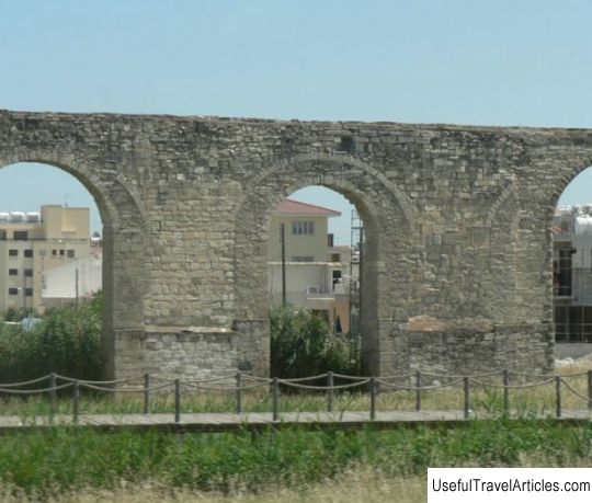
Aqueduct Kamares description and photos - Cyprus: Larnaca. Detailed information about the attraction. Description, photographs and a map showing the nearest significant objects. The title in English is Aqueduct Kamares. Photo and descriptionThe famous Kamares aqueduct, also known as the Bekir Pasha aqueduct, is located on the outskirts of Larnaca, one of the most popular tourist cities in Cyprus. It was created when this settlement, at that time it was called Skala, was under the control of the Ottomans, at the initiative of the ruler Abu Bekir Pasha and at his own expense in 1746-1747. The name "Kamares" (from the Greek "arches") suits him very well - the water supply is more than 10 kilometers long and consists of 75 high arches. A total of 3 "bridges" were created on 32, 12 and 31 arches - so that the water remained at the same level in those places where the aqueduct had to be laid along the ravines. Thanks to this, one of the main problems of the city, connected with the lack of water, was solved, before that people had to deliver water from the source, located a few kilometers from the village. And after the completion of the construction, water from the Tremitos River through the aqueduct flowed directly to Larnaca. The townspeople used such a system until 1939, when, finally, a modern water supply was built there. Unfortunately, to this day, Kamares has survived only partially - after the city began to be actively upset, the aqueduct was severely damaged ... Therefore, in the municipality of Larnaca, a special committee was created, consisting of specialists of different orientations, which must monitor the safety of this architectural and historical monument. In addition, active work is now underway to stop construction in the vicinity of Kamares and turn this area into a tourist pedestrian zone.   We also recommend reading Qatar Zoo (Doha Zoo) description and photos - Qatar: Doha Topic: Aqueduct Kamares description and photos - Cyprus: Larnaca. |


