Aqueduct (Skopje Aqueduct) description and photos - Macedonia: Skopje
Rating: 8,0/10 (587 votes) 
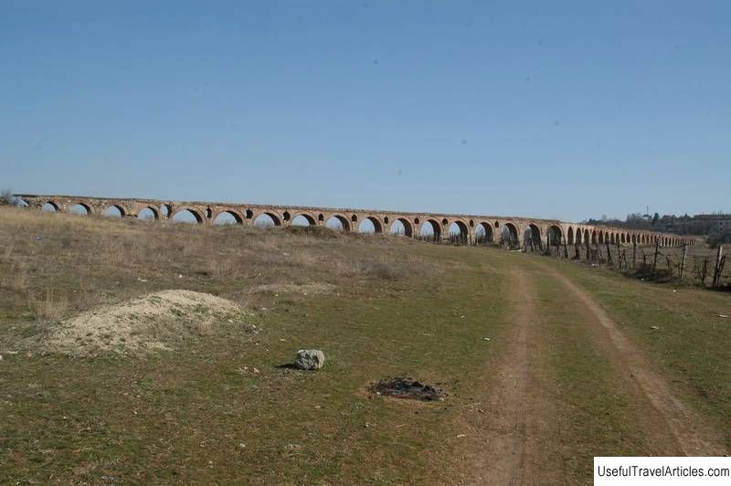
Skopje Aqueduct description and photos - Macedonia: Skopje. Detailed information about the attraction. Description, photographs and a map showing the nearest significant objects. The title in English is Skopje Aqueduct. Photo and descriptionThe only surviving aqueduct in Macedonia and one of three in the former Yugoslavia can be found 2 km north-west of Skopje, near the village of Vizbegovo. At present, only 386 meters of the rather long aqueduct have survived. This arched structure, built of stone and brick, is supported by 53 columns. At one site, the aqueduct makes a turn. It is unclear when it was built. Some scholars believe that this happened in Roman times. Its purpose was to supply drinking water to the Roman military camp of Skupi. Other researchers are sure that the aqueduct was erected during the reign of the Byzantine emperor Justinian I to serve the village of Justinian Prima, where the aqueduct was called Justinian. Finally, some historians believe that this building appeared in the XVI century, when the territory of present-day Macedonia was under the rule of the Ottoman Empire. The water from the aqueduct was to be supplied to numerous hammams and mosques in Skopje. The aqueduct is believed to have reached the center of Skopje. Water flowed through the aqueduct from the Lavovets mineral spring located in the present village of Gluvo in the Skopska Crna Gora mountains. It is located 9 km northwest of Skopje. Thus, one can imagine the length of the aqueduct. According to some reports, the aqueduct was used until the 18th century, and then it began to gradually collapse. It was last reconstructed after the 1963 earthquake in Skopje. Then three arches and two pillars destroyed by tremors were repaired.    We also recommend reading Church of the Assumption of the Blessed Virgin Mary with Paromenia description and photos - Russia - North-West: Pskov Topic: Aqueduct (Skopje Aqueduct) description and photos - Macedonia: Skopje. |


