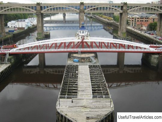
Hadrian's Wall description and photos - Great Britain: Newcastle-on-Tyne
Rating: 8,6/10 (4960 votes) 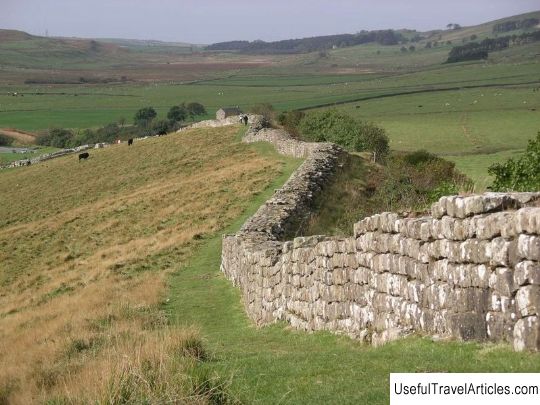
Hadrian's Wall description and photos - Great Britain: Newcastle-on-Tyne. Detailed information about the attraction. Description, photographs and a map showing the nearest significant objects. The title in English is Hadrian's Wall. Photo and descriptionHadrian's Wall (Hadrian's Wall) is a defensive fortification in the form of an earthen rampart, built by the Romans in Britain. This is the first of two such fortifications. The second shaft - the Antonina shaft was located to the north and is not so well known, because preserved much worse. Hadrian's shaft was 80 ancient Roman miles or 120 km long. Its height fluctuated depending on the place and building material. To the east of the Irting River, the shaft was built of rectangular stones, its width reached 3 meters, and its height - 5-6 meters. To the west of the river, the rampart was earthen, 6 meters wide and 3.5 meters high. There is a widespread belief that the Hadrian's Wall runs along the border of England and Scotland. This is not true, Hadrian's Wall is entirely located in England and is less than a kilometer from the border in the west and 110 kilometers in the east. The wall was built at the direction of the Roman emperor Hadrian, who is famous for visiting almost all the provinces of the Roman Empire during his reign. Construction of the wall began shortly before his arrival in Britain in 122 AD. Historians have not come to a consensus about why this wall was built. Perhaps it was meant to symbolize the power of the Roman Empire. Its functionality as a defensive structure is questionable, both from a military and from an economic point of view: did the Pictish tribes scattered across the northern plains really pose such a threat to the Roman Empire, and whether the rampart could successfully repel their raids. And wouldn't it be cheaper to simply annex these lands to the empire than to build and maintain such a shaft? After all, it was not just a wall piled or made of stones. Small fortifications were built at a distance of one ancient Roman mile from each other. Up to 17 full-fledged forts were built along the rampart, and the garrison of the wall sometimes exceeded 10,000 people. After the Romans left Britain, the rampart collapsed. Large sections of the wall were demolished during the construction of the road in the 18th century. But in the middle of the 19th century, John Clayton became interested in the wall. He began to buy out plots of land, where the remains of the rampart were preserved, so that the locals would not take the stones to their buildings. Then these lands were bought by the National Trust for the Preservation of Historical and Natural Heritage. In 2003, along the line where the Adrianov shaft passed,         We also recommend reading Memorial complex ”Line of Defense” description and photo - Russia - South: Novorossiysk Topic: Hadrian's Wall description and photos - Great Britain: Newcastle-on-Tyne. |