Chirka-Kem river description and photo - Russia - Karelia: Muezersky district
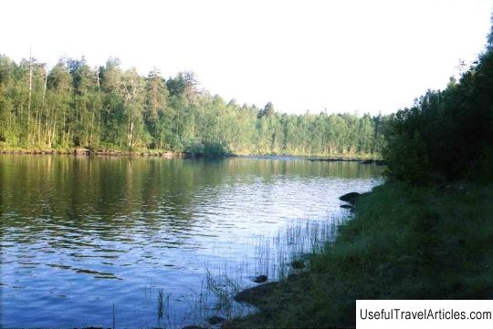
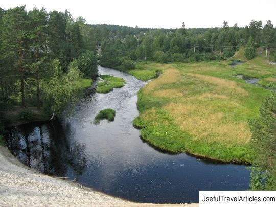
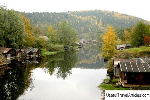
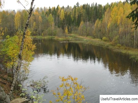
Rating: 8,7/10 (689 votes) Chirka-Kem river description and photos - Russia - Karelia: Muezersky district. Detailed information about the attraction. Description, photos and a map showing the nearest significant objects. Photo and descriptionThe Chirka-Kem River flows in the very center of the northern part of Karelia and is the right tributary of the Kem, which has a basin in the White Sea. The river is 221 km long. The beginning of the Chirka-Kem River is located in Lake Naomango. Along the course of its course, the river passes several lakes and finally flows into Lake Yushkojarvi. Due to the geological features of the region where the river flows, the Chirka-Kem is replete with a large number of obstacles, which are represented by rapids, rifts and rifts. The Chirka-Kem River is one of the most abundant and turbulent rivers in Karelia. In the period from November to May, it is completely covered with an impressive ice shell, however, the talkative rapids do not freeze even in the winter season. In winter weather, the beauty of the rapids-waterfalls is especially striking: white dense steam soars directly above the cascades of falling water, and the trees located in the coastal zone of the river sparkle with a surprisingly picturesque frost covering them. In the warm season, when the river ice melts, you can see that the river water is very dark, and in most places it is not transparent. The depth of Chirka-Kem is from 1 to 3 meters. As for the characteristic features of the river, they can be represented by three sections. The first section starts from the headwaters of the Chirka-Kem and up to Kalmozero. In this section of the river, it can be called a typical river in Karelia, reaching a width of 20 m and having especially swampy banks, but completely uncomplicated rapids. The course of the river in this area is almost imperceptible and has dark, almost opaque water. Chirka-Kem in this place is capable of spilling up to 40 m wide, as soon as it reaches the confluence of its left tributary with the Muezerka River. There are very beautiful views and landscapes located in the area where lakes Chelgozero, Kalmozero and Momsoyarvi are connected. The second section is represented by the territory from Kalmozero to the village of Borovoe. In this section, the river widens significantly, and the water discharge more than triples, which noticeably increases the flow. After reaching the site in the Chelgozero region, the width of the river channel reaches 80-140 m, and then narrows significantly to 20-45 m on powerful but short rapids. & Nbsp; On this site there is an unusual canyon - short, but especially picturesque. The height of the canyon walls reaches a height of up to 30 m, the beginning of the canyon was laid by the Curve rapids, which have an incredibly high current velocity and the so-called standing waves reaching heights of up to 1.5 m the end of the canyon falls on the Takhkopadun rapids, presented in the form of a large plum 2 m high. After passing Takhkopadun, Chirka-Kemi considerably calms down, overflowing in the form of a lake, and slows down its flow. These places are distinguished by picturesque views. Particularly striking are the cliffs overgrown with taiga in some places, from which numerous streams flow down in small waterfalls. A distinctive feature of Chirki-Kem is a particularly frequent change of natural landscapes. The third section of the river spills over 100 m wide. The river passes through numerous rapids and rifts and flows into the beautiful lake Yushkojarvi, located already on the Kem River. The site is characterized by a huge flow of water. In the coastal zone of the Chirka-Kem River, there are rock castles (selga), which reach heights of up to 100 m. On the banks of the river, you can see numerous huts of fishermen, rafters and mowers. Fish is especially good here: both with spinning and with a fishing rod. In the undergrowth, blueberries, bilberries, lingonberries can be found, and cloudberries are often found in the swamp zone. As for the passage of the river, but rarely when it is completely passed, because the lower course of the river is especially wide and has a large number of islands. The largest number of routes ends already in the village of Borovoe. The Chirka-Kem River is especially popular among numerous tourists, especially kayakers and kayakers. The attraction of the river lies not only in the most interesting water obstacles and picturesque landscapes, but also in its proximity to settlements and highways. In addition, berries and mushrooms can be picked in the coastal forests.          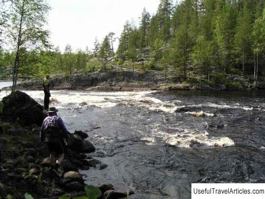    Topic: Chirka-Kem river description and photo - Russia - Karelia: Muezersky district. |