River Suna description and photo - Russia - Karelia: Kondopozhsky district
Rating: 8,7/10 (500 votes) 
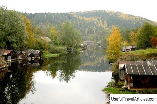
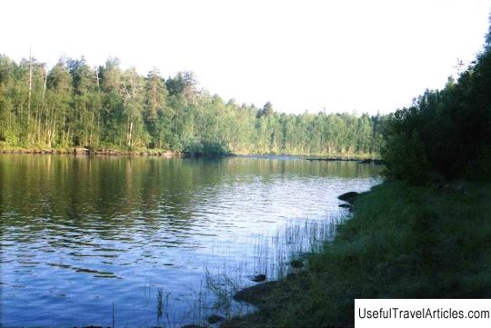
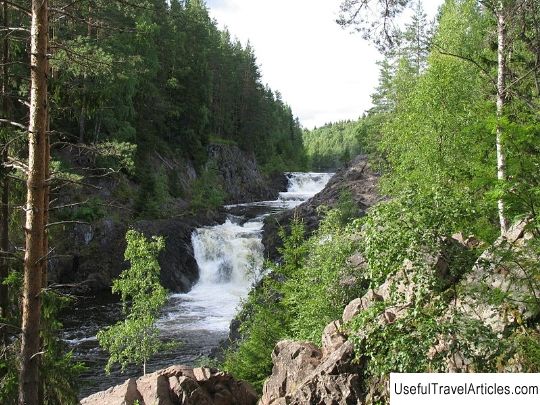
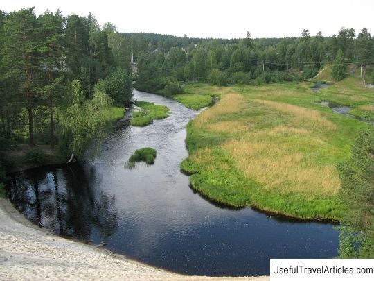
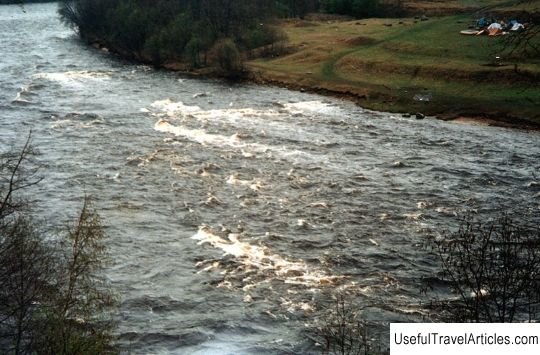
Suna River description and photos - Russia - Karelia: Kondopozhsky district. Detailed information about the attraction. Description, photos and a map showing the nearest significant objects. Photo and descriptionThe Suna River, flowing in the middle part of Karelia, is the second longest (280 km) and the third largest catchment in the region. The Suna River originates from the small lake Kiviyarvi, located in the West Karelian Upland. Until about. Kovdozero for 30 km the river is called Sun, and after Sun. The river flows into the Kondopoga Bay of Lake Onega. Almost a third of the length of the Suna River is occupied by lakes, and in the rest there is a rapid current, with rapids and waterfalls. There are more than 50 of them, the biggest drop is in the section of the river between 70 and 30 kilometers from Lake Kivijarvi, the mouth of the river. There are 3 famous waterfalls on this site: Girvas with a fall height of 14.8 meters, Por-Porg - 16.8 meters and Kivach - 10.7. However, in fact, you can only admire the third waterfall, the first two, due to the drainage of water to the Kondopoloskaya HPP, practically dried up. There is a project to periodically revitalize the waterfalls to show to tourists. The Suna River is very popular among boaters, especially beginners. Most of the rifts of the River are not difficult to pass. Rapids with strong rocky plums on the Suna are rare, but you should be very careful because you start pulling in them 30-40 meters away and you need to moor in advance to inspect them. The banks of the Suna are mostly rocky, but there are sandy areas with beaches. The relief is very beautiful, representing a moraine-ridge plain with slight elevation differences. Mostly coniferous forests of different ages prevail, with small areas of grassy bogs and small-leaved plantations. There are several routes of 1-2 category of difficulty on the river. The Suna has a slow current with an average channel width of about 50 meters. Basically, the rapids of the river belong to the first category of complexity, shivery type, long and difficult to walk. The banks are formed of heaps of stones and rarely have rocky outcrops. The strongest fall of the river falls on the lower reaches of three waterfalls. The river is ideal for family groups with little training, but you should not be negligent in safety, it is better if the group includes a person with experience in hikes of 2 and 3 categories of difficulty. There are many good parking lots on all routes of the river , mainly located in the forest. The only settlement on the river, not counting the drop / drop, is the village of Lindozero. The most popular rafting section on Suna starts from the village of Porosozero and ends in the village of Girvas.         We also recommend reading Historical Museum description and photos - Bulgaria: Asenovgrad Topic: River Suna description and photo - Russia - Karelia: Kondopozhsky district. |