Uchisar description and photos - Turkey: Cappadocia
Rating: 9,0/10 (7899 votes) 
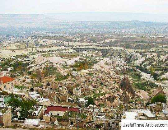
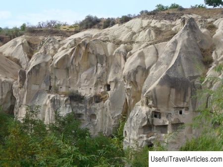
Uchisar description and photos - Turkey: Cappadocia. Detailed information about the attraction. Description, photographs and a map showing the nearest significant objects. The title in English is Uchisar. Photo and descriptionUchisar is located in the central part of Cappadocia, in the east of Asia Minor and is one of the most densely populated villages in the area. In fact, of course, most of the population lives in a modern village, built near the famous rocks, but there are living quarters in the rocks themselves. This settlement is located in the center of the triangle formed by three cities: Nevsehir, Goreme and Yurgup. That is why the city was named Uchisar (three fortresses), “hisar” in Russian means a fortress. It is a natural citadel. In these rocks, presumably, it was quite convenient and practical to settle, since on one side tuff is a very malleable material, so it was easier to hollow out a cave inside such a rock than in a stone ... On the other hand, in such caves it was more convenient to hide and observe the appearance of enemies on the horizon: from the side, nothing is visible, except for a small opening-entrance. Sometimes you won’t guess how big those hidden inside the room can be. Some caves are now being completed and rebuilt: they seem to be used as barns and sheds. Some of the modern houses are generally close to the caves. Currently, the mountain village is used to attract tourists. The owners of such houses earn by selling all kinds of souvenirs (from knitted socks to figurines). At the very bottom of the cliff there are premises closed for tourists. Perhaps, they still live in, although, most likely, the locals come here “to work” from the neighboring village. The city is famous for its fortress carved into the rock, which stands at the top of the hill. The Uchisar Fortress is a one-of-a-kind rocky settlement with towers and spiers of white tuff located around the central peak on which it rises. This huge rock looks like Swiss cheese with holes. The entire fortress is dotted with rooms, tunnels and labyrinths. From the top of the cliff, a gorgeous view of the entire valley opens. Climbing it, you can gaze almost all of Cappadocia. From here you can also see the mysterious Valley of Love, with which many legends and stories are associated. "Citadel"; rises above the village for several tens of meters. It appears in the form of a large cylindrical tower on the west side and is supported by a rocky spur, as if carved with a scalpel. Tunnel, having a length of one hundred meters and laid in the mountain in ancient times, stretches under the houses. It served to connect the fortress with the outside world, and in the event of a siege, it was used to supply the city with water. Having admired the canyon located at the base of Uchisar, you can go down and walk a little to the edge of a cliff of several hundred meters. This is a shepherd's road, cattle from Uchisar are walked here, there is a lot of grass and there is drinking water. Below is a valley, almost completely adapted for viticulture and horticulture. This is a very impressive picture: gardens mixed with vineyards, scorching sun, and all around there is silence, not a soul, and only sometimes the rustle of grass is heard. Pigeons played an especially important role in Cappadocia. Their droppings were used as fertilizer for the grapes grown here, from which fine wine is then made. Small holes scattered throughout the rocks were used as pigeon houses to collect droppings. Judging by their location (it's hard to imagine how the locals climbed there) and the number of these holes, pigeon droppings were really very important, and there were a whole cloud of pigeons there.        We also recommend reading Linderhof Castle description and photos - Germany: Bavaria Topic: Uchisar description and photos - Turkey: Cappadocia. |


