The Southwest National Park description and photos - Australia: Tasmania
Rating: 8,6/10 (1533 votes) 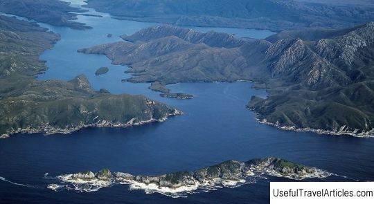
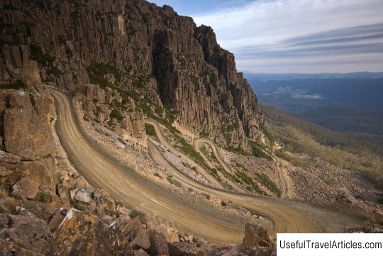
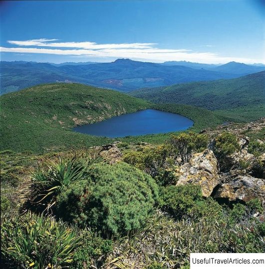
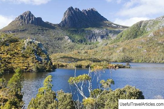
The Southwest National Park description and photos - Australia: Tasmania. Detailed information about the attraction. Description, photographs and a map showing the nearest significant objects. The name in English is The Southwest National Park. Photo and descriptionThe largest national park in Tasmania - South-West - spreads over an area of 618 thousand hectares, 93 km west of Hobart. It is known for its inaccessible, but surprisingly beautiful, pristine wilderness. The weather here is incredibly changeable and often quite harsh. Over the past 25 thousand years, the main inhabitants of these places were the few aborigines of Tasmania, and Europeans only rarely appeared here, which ensured the safety of the territory. Only one road passes through the park - it leads to the town of Stratgordon. The southern and western parts of the park are absolutely inaccessible to any land transport - you can only get there on foot, by boat or by air. A small airstrip for aircraft is located in the tiny settlement of Melaleuca in the southwest of the park. There are also two huts for tourists. The "core" of this protected area was established in 1955 and was originally called Lake Pedder National Park. Over the next 35 years, the park's territory expanded and renamed until it reached its current size in 1990. Today, the park has two major hiking trails: the Port Davie Trail, which begins south of Lake Pedder, and the South Shore Trail, which leads from Cockle Creek. Both are intended primarily for experienced hikers, taking 10 to 14 days to navigate. There are also more difficult routes, capturing the Eastern and Western Arthur Range mountain ranges, Southwest Cape and Federation Peak. For the less sophisticated hikers, trails that take several hours of travel are suitable, for example, the road to the Eliza plateau, which offers wonderful views of Mount Ann and the lakes lying in the valley. Alternatively, you can take the 8-hour trek to Judd Glacial Lake, surrounded by steep cliffs. A real pristine world will open before tourists: rain forests, thickets of myrtle trees, luxurious wild flowers and berry bushes. Among this lush splendor, you can see green rosellas, honey suckers, black flute birds, famous for their loud songs. It is said that it is here, in the Southwest National Park, that the best fishing spots in Tasmania are located. At Gordon and Pedder Lakes you can try to catch trout. Another popular spot for fishermen is the Edgar Dam near Scotts Peak.         Topic: The Southwest National Park description and photos - Australia: Tasmania. |