Piz Badus mountain description and photos - Switzerland: Andermatt
Rating: 8,3/10 (709 votes) 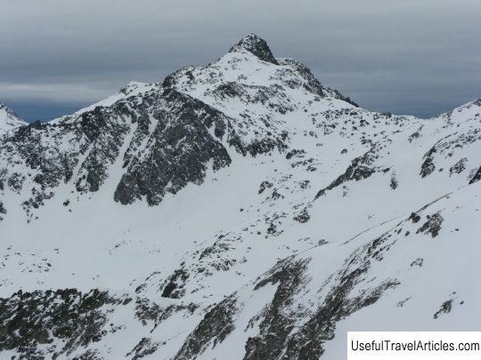
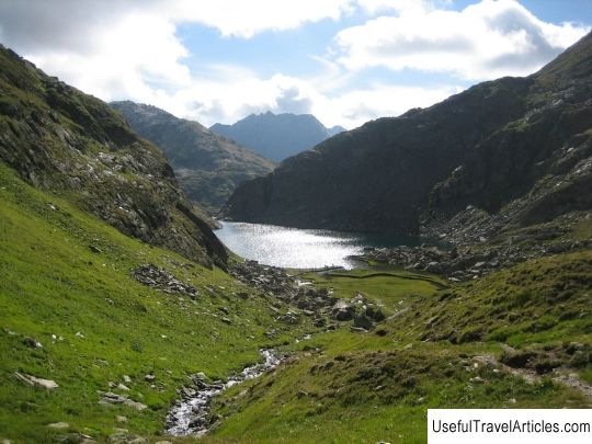
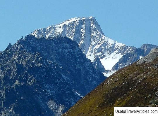
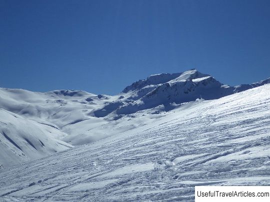
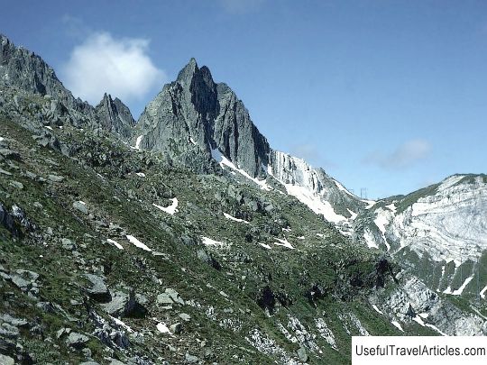
Piz Badus mountain description and photos - Switzerland: Andermatt. Detailed information about the attraction. Description, photographs and a map showing the nearest significant objects. The title in English is Piz Badus. Photo and descriptionMount Piz Badus, also called Six Madun, is part of the Gotthard massif, reaches an altitude of 2928 meters above sea level, and the border of the cantons of Graubunden and Uri passes through its peak. The unique geographical position allows the mountain, despite its small size, to be considered one of the best observation platforms, from which magnificent views of the surroundings, as well as other mountain ranges of the Swiss Alps, open. Piz Badus is located on the watershed between the Peredny Rhine and Reuss rivers. On the east side, it ends with a 1000-meter precipice into the Unteralp Valley. From the north-east, the mountain slope is washed by Lake Tomasee, officially considered the source of the Rhine River. The waters from the northern and eastern slopes flow into the Rhine da Tuma stream, and from the south to another tributary of the Rhine - the Meighelsrein stream. The name Badus comes from the Swiss Romansh language and literally means “crooked standing”. The Benedictine priest Placidus-a-Spesha and his companion Fintann Birchler were the first to try to climb Mount Piz Badus. But only Placidus was able to reach the top. Despite his venerable rank, he was a fairly active climber and had a wealth of climbing experience. Nowadays, there are three ways to get to the top of Piz Badus. The first one starts from the Badushutte hut, runs along the Tomasee and continues through the north-western ridge, the difficulty of this route is estimated at T4; in the immediate vicinity of the summit, climbing equipment will be needed to climb. The remaining two paths are partially impassable and are only suitable for experienced climbers.      We also recommend reading Mouse Museum description and photo - Russia - Central District: Myshkin Topic: Piz Badus mountain description and photos - Switzerland: Andermatt. |