Primorsky Boulevard description and photo - Crimea: Sevastopol
Rating: 8,0/10 (198 votes) 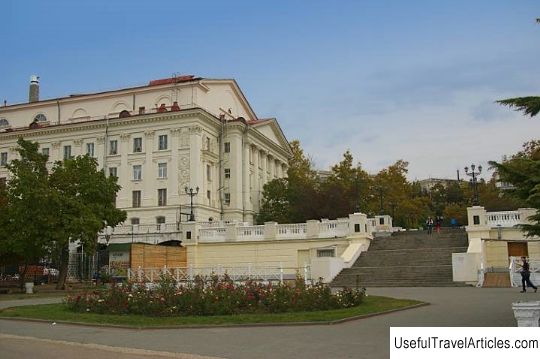
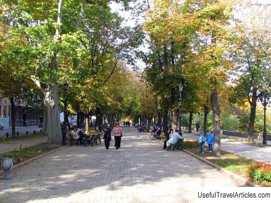
Primorsky Boulevard description and photos - Crimea: Sevastopol. Detailed information about the attraction. Description, photos and a map showing the nearest significant objects. Photo and descriptionPrimorskiy Boulevard in Sevastopol is the most popular vacation spot for residents and guests of the city. These are picturesque alleys, a complex of monuments and a magnificent view of the Sevastopol Bay. The remarkable ensemble of Primorsky Boulevard consists of interconnected and compositionally merged parts, which were planned and landscaped at different times. The Sevastopol Boulevard was destroyed on the site of the Nikolaev coastal battery, erected before the start of the Crimean War of 1853-1856. and destroyed in January 1856 by the French. Piles of ruins have been rising here for quite a long time. And only in 1883 the local authorities decided to break up the boulevard at this place. Two years later, shrubs and trees were planted here, walking areas were equipped. A yacht club with a restaurant and reading room was built in the western part of the boulevard. The new boulevard was named Primorsky and has become a wonderful vacation spot that attracts all local residents. In the 90s. of the last century, a theater was built on Primorsky Boulevard, where F.I. Chaliapin, V.F. Komissarzhevskaya, M.S. Shchepkin and others. Unfortunately, the theater building has not survived to this day. At about the same time, the first marine biological station in Russia for the study of the flora and fauna of the sea was opened on Primorsky Boulevard. A magnificent complex of monuments serves as the decoration of Primorsky Boulevard. So for the 50th anniversary of the defense of Sevastopol in 1854-55. 25 meters from the coast, a Monument to the Sunken Ships was erected - it became one of the main symbols of the city. A memorial plaque is installed on the stones of the granite embankment, reminiscent of the heroic uprising of the sailors of the cruiser "Ochakov" on November 12, 1905. On the 35th anniversary of the liberation of the city from German invaders, a memorial sign to the Black Sea Fleet squadron was solemnly opened on the boulevard embankment, which has become an eternal symbol of the heroic glory of the Black Sea sailors in the defense of the city. Throughout the history of its existence, the boulevard has been repeatedly reconstructed and expanded. In 1949, architects G.G. Schwabauer, P.V. Kumpan and I.A. Saburov developed a project, thanks to which Primorsky Boulevard was significantly changed and embellished, and its length increased.      We also recommend reading Bad Zell description and photos - Austria: Upper Austria Topic: Primorsky Boulevard description and photo - Crimea: Sevastopol. |