Natural Park of Monte Beigua (Parco Naturale Regionale del Beigua) description and photos - Italy: Arenzano
Rating: 7,5/10 (100 votes) 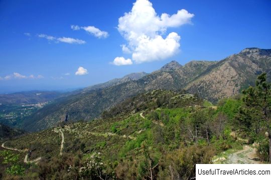
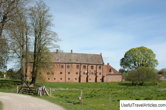
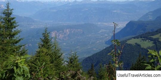
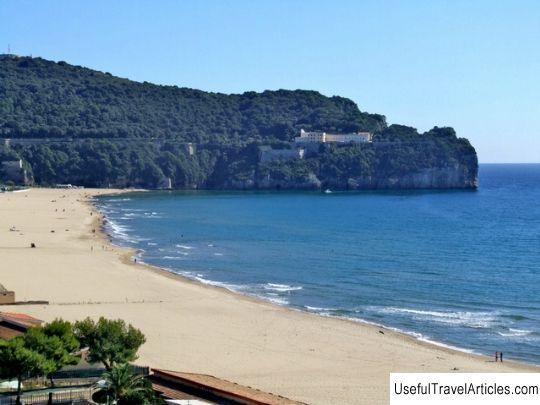
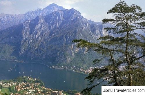
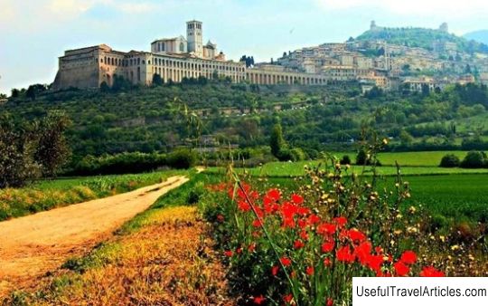
Monte Beigua Natural Park (Parco Naturale Regionale del Beigua) description and photos - Italy: Arenzano. Detailed information about the attraction. Description, photographs and a map showing the nearest significant objects. The title in English is Parco Naturale Regionale del Beigua. Photo and descriptionNatural Park of Monte Beigua is the largest regional park in the Italian region of Liguria, located in a picturesque location between the mountain range and the sea. The mountain range stretches for 26 kilometers parallel to the Ligurian Riviera from Colle del Jovo to Passo del Turchino. Its highest peaks are Monte Beigua (1287 m), Chima Frattin (1145 m), Monte Rama (1148 m), Monte Argentea (1082 m) and Monte Reiksa (1183 m). On the slopes of these mountains and in the valleys between them, there are grass meadows and ecologically valuable wetlands, dense forests with thickets of beech, oak and chestnuts, whole groves of seaside pines and Mediterranean bushes. The park is considered one of the richest in the number of different ecosystems of protected areas in Liguria. And the European Community recognized Monte Beigua as a territory of special importance for birds - over 80 nesting bird species have been registered here, including golden eagles, snake eagles, stone thrushes, nightjars and common shrikes. The park's forests are home to wolves, wild boars, roe deer and fallow deer, and from the cliffs facing the sea, silhouettes of whales sailing past the coast can be seen. Three forest groves - Devia in the municipality of Sassello, Lerone in the municipalities of Arenzano and Cogoleto and Tiglieto in the municipalities of Tigleto, Mazone and Campo Ligure - have been taken under special state protection. In 2005, the so-called Beigua Geopark was formed, which included the territory of the Monte Beigua Natural Park and the adjacent lands. This UNESCO-recognized Geopark is spread over an area of 40,000 hectares in several Ligurian municipalities. Landmarks illustrating the region's geological history are rocky outcrops, ore deposits containing fossilized organisms and incredible geological formations created by water and wind. Of course, one cannot fail to mention the monuments of history and culture, scattered throughout the territory of Monte Beigua and testifying to the evolution of human settlements in these places. Paleontological finds made in the forests of the park indicate that the first hunters and shepherds appeared here in the prehistoric period. Later, this area became an important communication route between the coast and the Po river plain. In 1120, the Abbey of Badia di Tiglieto, also known as Santa Maria, was founded on the plain of the small river Orba, the first Cistercian abbey created outside of France. It consists of a church in the northern part, a monastery in the eastern part and a refectory. All three buildings are sides of the cloister, and the fourth side and the adjacent land were occupied by agricultural buildings. The abbey was recently renovated, and in 2000, the Cistercian monks returned to it. Nearby there is a five-arch stone bridge in Romanesque style, which crosses the Orba River and leads to an old mill. Among other attractions of the Monte Beigua park, it is worth noting the rock paintings of the Neolithic period in the town of Casa Bucastrella, the "road of the megaliths" in Alpicella, the Milk Valleys - Valley del Latte, lying between the municipalities of Mazone, Campo Ligure, Rossiglione and Tiglieto, the Valle del Lerone, favored by birdwatchers for a huge number of birds of prey, which are best seen in spring and early autumn, the Bellavista castle in the Devia forest and the Filigree Museum in Campo Ligure. And, of course, you should definitely visit the confectionery factory in Sassello, where the world famous "amaretti" and "canestrelli" are produced.         We also recommend reading Agurskie waterfalls description and photos - Russia - South: Matsesta Topic: Natural Park of Monte Beigua (Parco Naturale Regionale del Beigua) description and photos - Italy: Arenzano. |