Parque Nacional Torres del Paine description and photos - Chile: Puerto Natales
Rating: 8,5/10 (1930 votes) 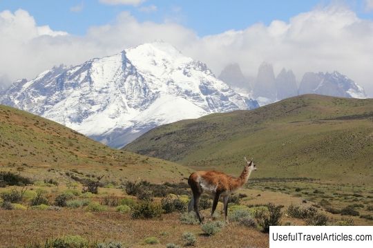
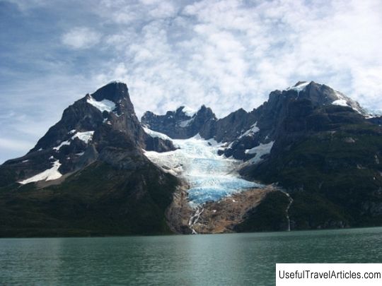
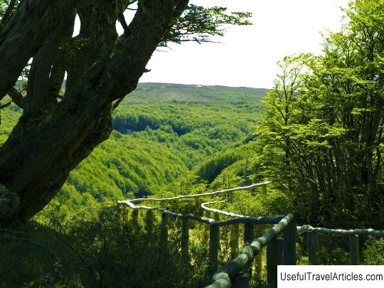
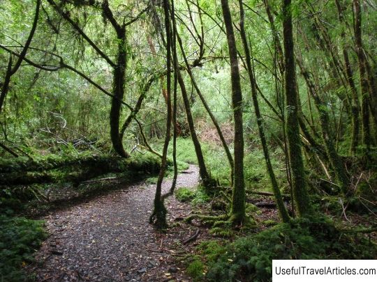
Parque Nacional Torres del Paine description and photos - Chile: Puerto Natales. Detailed information about the attraction. Description, photographs and a map showing the nearest significant objects. The title in English is Parque Nacional Torres del Paine. Photo and descriptionTorres del Paine National Park (2,420 sq. km) is one of the largest and most beautiful parks in the country. It is the third most visited, about 75% of visitors are foreign tourists. The national park is located 112 km north of Puerto Natales and 312 km from the city of Punta Arenas. Torres del Paine is one of eleven protected areas in Magallanes and Chilean Antarctica (together with four other national parks, three national reserves and three national monuments). Together, these protected areas cover 51% of the region's area (6,728,744 ha). The park was established in 1959. In 1978, UNESCO announced that it was added to the list of biosphere reserves. Torres del Paine Park is characterized by a rich fauna, flora and unique geography, making it an ideal destination for ecotourism and mountaineering, for all those who love the thrill to experience the proximity to the territory unknown by man. Due to the movements of the earth's crust 12 million years ago the formation of impressive snow-capped peaks, such as Pine Grande (3050 m), Los Cuemos del Paine (2600, 2400, 2200 m), Torres del Paine (2250, 2460 and 2500 m), Fortaleza (2800 m) , Escudo (2700 m). Having visited the Torres del Paine park, tourists definitely want to see the most spectacular Glacier Gray glacier (area of 270 sq. Km, 28 km long) - it is the third largest on Earth. The park is laced with numerous rivers and streams , lakes, ponds and waterfalls that start their way from the glaciers of South Patagonia and end in the northeast at the Ultima Esperanza fjord, washing the coast of the city of Puerto Natales. The waterways of the rivers have sharp elevation changes on the slopes, creating waterfalls and rapids. The largest rivers are Pingo, Payne, Serrano and Gray. You can visit the shores of the lakes: Dixon, Torro, Sarmiento, Nordenskjold, Peoe, Gray, Payne, see the magnificent waterfalls: Payne, Salto Grande, Salto Chico. The last major study to study the flora of the park was carried out in 1974 year. This study identified four biotic zones that make up the entire area of the park, defining the `` vegetation type '': mosses, deciduous forest, steppe, Andean desert. Here you can see cypresses, several types of beech, evergreen oak "coigues", all kinds of shrubs, herbaceous plants, many flowers: clover, a rich variety of orchids. The fauna of the park is very diverse. You can see guanacos, foxes, skunks, Andean deer, armadillos, parrots, rhea, condor, eagles, various waterfowl ducks, coots, black-necked swans, kingfishers, woodpeckers, blackbirds, puma. The park is located in a cold zone. rainy temperate climate, no dry season. The weather conditions in the park are quite varied due to the complex topography. The rainiest months are March and April, with little or no precipitation from July to October. The area is characterized by cool summers with temperatures below 16 ° C. Average minimum temperature in winter -2.5 ° C.       We also recommend reading Holy Cross Church (Svento Kryziaus baznycia) description and photos - Lithuania: Vilnius Topic: Parque Nacional Torres del Paine description and photos - Chile: Puerto Natales. |