Kaminaljuyu Mayan site description and photos - Guatemala: Guatemala
Rating: 8,3/10 (1290 votes) 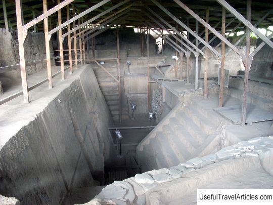
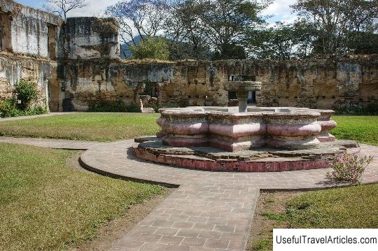
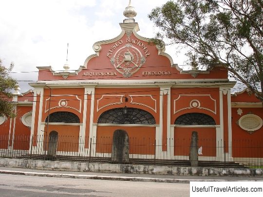
Kaminaljuyu Mayan site description and photos - Guatemala: Guatemala. Detailed information about the attraction. Description, photographs and a map showing the nearest significant objects. The name in English is Kaminaljuyu. Photo & DescriptionCaminaljuyu, located in the central valley of Guatemala, is one of the few well-preserved Mayan complexes in the region. This is a unique example of an architectural complex of complex adobe buildings, some of which have burial chambers, reliefs and painted surfaces that emphasize the richness of the ancient culture. Its strategic location allowed at one time to control a number of important trade routes. According to research, the site is believed to have been the largest producer and exporter of obsidian, which was mined in several nearby quarries. Between 1000 BC and 200 AD Kaminalhuyu ("ancestral place" in the Mayan Quiche language) was one of the most important centers in the southeastern part of Mesoamerica. This place was discovered at the beginning of the twentieth century. More than fifty archaeological sites have been discovered in Caminalhuyu over the past 100 years. In addition to excavations, scientists have described the sculptures and made maps of the area. In 1925, Manuel Gamio began his search, finding deep cultural deposits, debris and clay figurines of the "middle culture" layer of Mesoamerica. Ten years later, when clearing the site for a football field, two mounds were discovered that turned out to be ancient burials. These two hills are still the largest finds in the settlement, part of a complex of seven buildings. For researchers, rich royal tombs were opened, presumably the dynasty of rulers of the pre-classical Kaminalhuyu era. In the early 1950s, Heinrich Berlin excavated a large mound in an ancient pre-classical layer. In the 1960s, Pennsylvania State University conducted extensive excavations at Caminalhuyu. In the 1990s, Marion Popeno de Hutch and Juan Antonio Valdes conducted research in the southern areas of the site, and a Japanese team explored a large mound near the modern archaeological park. In 1970, great discoveries were made in Mayan hieroglyphic texts that challenged earlier theories about the origins of this civilization. The proximity of the ever-expanding city prompted the government to place Caminalhuyo in 2010 on World Monuments Watch's list of endangered cultural sites. This contributed to the improvement of the archaeological research park of the settlement, an educational center for visitors and tourists was built with detailed information on the state of excavations and finds. Funding was provided by the Japanese government. The old tunnels of the 1960s excavation were backfilled, and the World Monuments Fund helped fund the development of new protective cover projects for two archaeologically sensitive areas to protect fragile material from erosion.  We also recommend reading Bait Al Zubair Museum description and photos - Oman: Muscat Topic: Kaminaljuyu Mayan site description and photos - Guatemala: Guatemala. |