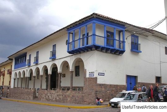
Ruins of Choquequirao description and photos - Peru: Sacred Valley
Rating: 7,7/10 (789 votes) 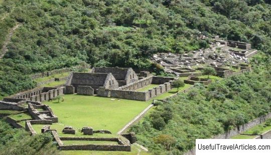
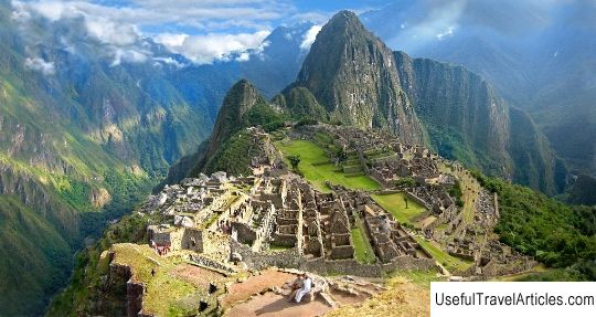
Choquequirao ruins description and photos - Peru: Sacred Valley. Detailed information about the attraction. Description, photographs and a map showing the nearest significant objects. The title in English is Choquequirao. Photo and descriptionThe ancient Inca city of Choquequirao is located in the spurs of the Salkantay mountain range at an altitude of 3,030 m above sea level, 98 km from the city of Cuzco. This ancient city is considered the `` sister city of Machu Picchu '' due to its similarity in architecture and structure. Choquequirao was built by the Incas in the 15th century. This city had two main stages of development. This can be explained by the fact that the city of Choquequirao was founded by Pachacutec - the ninth emperor of the Incas (1438-1471), after which his son Tupac Inca Yupanqui, becoming the tenth emperor (1471-1493), rebuilt and extended its life. Colonial documents indicate that Tupac Inca Yupanqui ruled Choquequirao, as his great-grandson, Tupac Sauri, confirmed ownership of this territory and neighboring lands during the Spanish colonization. Choquequirao was probably one of the checkpoints to the city of Vilcabamba - the last refuge of the Incas until 1572, as well as an administrative center performing political, social and economic functions. On its streets you can see the symbolic patterns of the imperial capital, places for rituals, mansions for the nobility, artisan houses, warehouses, large dormitories and farm terraces. In the past decade, the Peruvian government is trying to attract more scientists interested in the study of Inca culture to restore the partially excavated Choquequirao and make it more accessible to tourists. To get here, guided tourists will have to overcome a 60 kilometers path in 4 days through one of the deepest canyons in the world, along which the Apurimac River flows. This canyon is known for its snow-capped peaks, green Amazonian jungle slopes and steep cliffs. Excursion routes to the Choquequirao ruins are carefully designed to show tourists the real life in the Andes. There are currently three trails in use leading to Choquequirao - through Kachora, through Huanypaka and through Yanama. Recently, more than 5000 people annually make an exciting journey to the ruins of Choquequirao.         We also recommend reading Pskov Academic Drama Theater. A. S. Pushkin description and photo - Russia - North-West: Pskov Topic: Ruins of Choquequirao description and photos - Peru: Sacred Valley. |