Wadi Hammamat description and photos - Egypt: Marsa Alam
Rating: 7,8/10 (2930 votes) 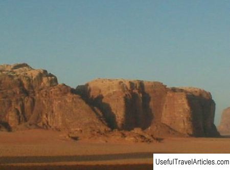
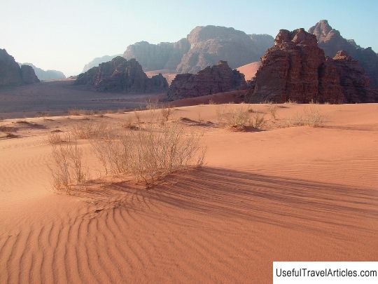
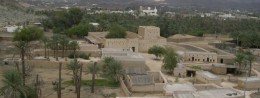
Wadi Hammamat description and photos - Egypt: Marsa Alam. Detailed information about the attraction. Description, photographs and a map showing the nearest significant objects. The title in English is Wadi Hammamat. Photo and descriptionWadi Hammamat is one of several dry river beds in the Egyptian desert and a modern road that leads to the Red Sea coast. The route was used for millennia as a trade route from the sea coast to the Nile, but the area was also famous for its quarries and gold mines. Hundreds of ancient ruins are located along the route; the remains of watchtowers, fortresses, catchments and mines from different historical periods testify to ancient mining activities. Many hieroglyphs and graffiti drawings on the rocks have made the famous ancient dry bed. These inscriptions and paintings record the activities of various expeditions for valuable resources. There are artifacts confirming that prehistoric people and nomads lived in the desert, which left on the rocks rough petroglyphs in the form of curved reed boats, hunting scenes and long-extinct animals. This route through the eastern part of the desert mountains was used by travelers and expeditions from the Old Kingdom to the Roman era, when quarries and gold mines were most exploited. The Romans built stone towers on the peaks of the hills to guard roads and wells. The territory of Wadi Hammamat is rich in sandstone, graywacke and shale rocks, they were prized for their variety of colors - from dark basalt to red, pink and green slabs used to decorate statues, sarcophagi and small sanctuaries. An ancient document was found here. - papyrus, which is the oldest geological and topographic map of Egypt. It was compiled during the expedition of Ramses IV. The map describes a specific section of the path through the wadis and marks iconic locations such as hills, quarries and mines. The Beckhen Quarry on the north side of the road retains the remains of dark shale working huts on the leeward side. Traces of mining are visible everywhere, and halfway to the top of the cliff there is an abandoned sarcophagus that cracked during quarrying. On the southern side of the road, the cliffs are dotted with inscriptions left by members of the pharaoh's expedition. The road to Wadi Hammamat passes through desert and cliffs, descends into a gorge between high dark, uneven mountains, so it is better to book a guided tour. Special permission is required for video, photography and stopping near graffiti.    We also recommend reading Assumption cave monastery description and photos - Crimea: Bakhchisarai Topic: Wadi Hammamat description and photos - Egypt: Marsa Alam. |