Fort San Pedro description and photos - Philippines: Cebu
Rating: 8,0/10 (155 votes) 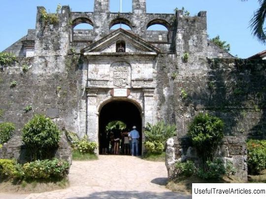
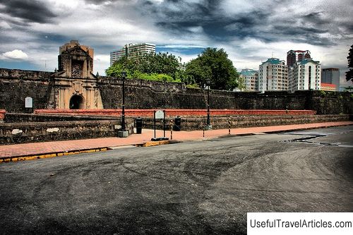
Fort San Pedro description and photos - Philippines: Cebu. Detailed information about the attraction. Description, photographs and a map showing the nearest significant objects. The title in English is Fort San Pedro. Photo and descriptionFort San Pedro is a military defensive structure built by the Spanish conquistadors under the leadership of Miguel Lopez de Legazpi. The fort is located on the territory of the current Plaza Independence in the city of Cebu, the capital of the Philippine province of the same name. The construction of this fortress began in 1565 and was completed only two centuries later - in 1738. Today, this triangular bastion is considered the oldest fort in the Philippines, and it is also the smallest. For many years of its history, Fort San Pedro was not only a defensive structure, but also a stronghold of the revolutionary movement of the Philippine people in the late 19th century, a prison and even a zoo. The fort has the shape of a triangle, two sides of which are facing the sea, and the third - to the land. The "sea" walls were reinforced with guns and a wooden fence. The fortifications of the fort were named La Concepcion, Ignacio de Loyola and San Miguel. The total area of the fort was only a little more than 2 thousand square meters, the height of the walls reached 6.1 meters, and the thickness was 2.4 meters. The length of the fence was 380 meters. The walls of the fort were of different lengths, and the one that faced the city contained the entrance to the fort. In total, the fort was defended by 14 guns, most of which have survived to this day. Until now, relatively little is known about what activities were carried out on the territory of the fort from the mid-16th century until 1739, when King Philip II of Spain demanded detailed information about the island of Cebu and its fortified structures. In the late 19th century, the fort was restored as part of the Cebu City Development Program. During the American domination, the fort housed US military barracks, which later - from 1937 to 1941 - housed a school for local residents. During the Second World War, Japanese residents of Cebu found refuge within the walls of the fort, and after the war, a military camp was based here. In 1957, the public in Cebu was alarmed by the message about the possible demolition of Fort San Pedro - a new city administration building was planned to be built in its place. At the same time, a movement began in defense of the historical monument, whose activists reached the highest echelons of power. Fortunately, the fortress was defended, but for several years a zoo was located on its territory, which was led by a local religious sect. By 1968, the walls of the fort and its facade were in a terrible state. In a short time, a plan for the restoration of the building was developed, and it was decided to move the zoo to another location. The restoration process was long and tedious: in order to recreate the appearance of the fort as close as possible to the original, corals raised from the bottom of the sea were used. After a year and a half, the facade, the main building, the alley and the roof garden of the observation tower were completed. The main building houses the office of the Department of Tourism, and the Lieutenant Barracks houses a museum that houses documents, drawings and sculptures from the Spanish period. The courtyard was turned into an open-air theater, and a park was laid out around the fort itself, where huge statues of Miguel Lopez de Legazpi and Italian navigator Antonio Pigafetta, a member of the Magellan expedition, were installed.          We also recommend reading Royal Palace of Rabat (Dar-al-Makhzen) description and photos - Morocco: Rabat Topic: Fort San Pedro description and photos - Philippines: Cebu. |
