Gorodische Velye description and photo - Russia - North-West: Pushkinskie Gory
Rating: 8,6/10 (869 votes) 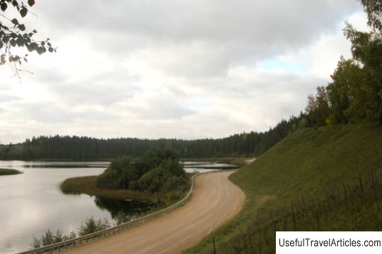
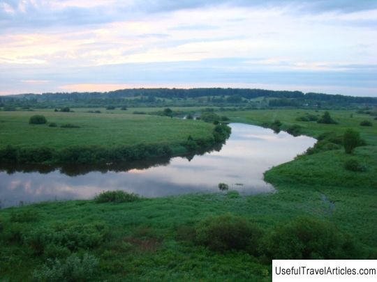
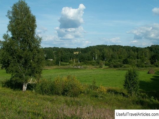
Gorodische Velye description and photos - Russia - North-West: Pushkinskie Gory. Detailed information about the attraction. Description, photos and a map showing the nearest significant objects. Photo and descriptionVelye is a village and settlement, which became the center of the Veleiskaya volost in the Pushkinogorsk district of the Pskov region. The village is located on the Valdai Upland. The name of the village comes from the Finnish word "sluggish", which means "free, spacious space", in the landscape of which lakes, hills and valleys alternate. Even in ancient times, the inhabitants of this area were engaged in the cultivation of flax, livestock, poultry and berry production. The village that has survived to this day, which is located between flat hills along the ancient roads leading to Livonia and Lithuania, has retained its former layout: long narrow streets go down to the lake right from the hill. Not far from this area flow the rivers Sinyaya, Great Isa, which were part of the ancient path called "from the Varangians to the Greeks", connecting the Russian lands with Livonia. The earliest mentions of the settlement are and are indicated in the Pskov chronicle dating back to 1368. But the first inhabitants of this settlement - the Slavs-Krivichi - settled the land much earlier. According to archaeological research, we can conclude that the hypothesis of NI Kostomarov concerning the existence of a city in a tract called "Mane" is indeed true. The initial development of the territory dates back to the end of the first millennium. It is known that the settlement existed in ancient times. The main attraction of the village is the Veleiskaya fortress. On the Pskov territory, which occupied a relatively small space, during the 14-15 centuries there were much more fortresses, than in the territory of Moscow Russia. In order to protect the Pskov lands from the raids of enemies, large fortresses-suburbs were erected, represented in the north by Gdovoy, in the south by Kotelno, Ostrov, Voronich, Vrevov, in the west by Izborsky. To a greater extent, in the north, the fortresses were built of stone, and in the south they were a somewhat ramified end of the border part. The Veleiskaya fortress was a wooden-earth-stone building, which became a unique phenomenon for the entire Pskov land. The fortress is located on an extensive gentle hill and is 260 meters long and 70 meters wide. The fortress was equipped with an earthen trough, which was surrounded by three lakes. The fortress was built in the middle of the 14th century. She defended an important junction of land roads leading from Lithuania to Moscow, Novgorod and Pskov. The second road ran from Livonia through Velje and was a link between the cities of Livonia and Novgorod and Pskov. The fortress was located on a large and perfectly preserved to our time earthen embankment, surrounded by lakes Chado, Chernoe and Velie. Lake Chado occupies an area of 70 hectares, and also adjoins a large rampart from the north-west, with what is connected with a large number of legends. On the south-western side of the rampart, Lake Velje spills over, occupying an area of 278 hectares. At the beginning of the 17th century, the village of Velie was granted to one of Peter the Great's associates - Count Yaguzhinsky. Soon after that, in 1777, the estate passed into the hands of Count Potemkin. In the middle of 1780, the village of Velye was visited by Catherine II herself, who was literally fascinated by the incredible beauty of these places. The Empress decided to build her own country palace in this place, although she did not fulfill her desire. In 1782, the estate passed into the possession of Lanskoy, who was Catherine's favorite, after which a prince named Kurakin became the owner of Velie. In 1808, Velie became known as an industrial facility thanks to the construction of a linen factory. In the 19th century, an unprecedented rise in flax cultivation took place, which is why fairs began to be held every year: Vozdvizhenskaya, two Fominskaya and Tresvyatitelskaya. An old post road leading from Polotsk to the city of Novgorod ran through the territory of the Velei settlement. The processing of flax, as well as its sale, laid a successful start for the merchant dynasties in Velje. At this time, the Old Believers began to appear. It is especially important to note that that the settlement of Velye is located not far from the A.S. Pushkin, and not so long ago became a part of it.     We also recommend reading Church of St. Apostles (St. Aposteln Kirche) description and photos - Germany: Cologne Topic: Gorodische Velye description and photo - Russia - North-West: Pushkinskie Gory. |