Geological outcrops of Devonian and Ordovician rocks on the Saba river description and photo - Russia - Leningrad region: Luga district
Rating: 8,2/10 (455 votes) 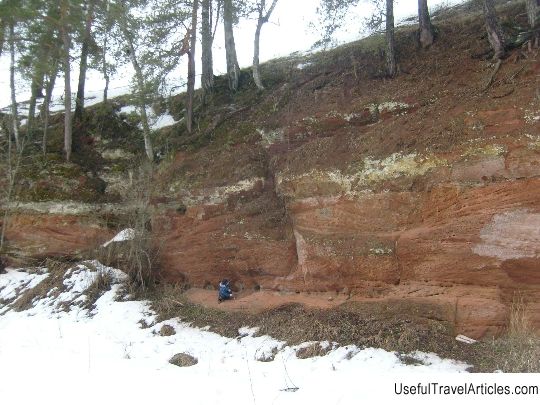
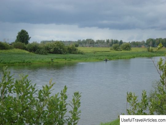
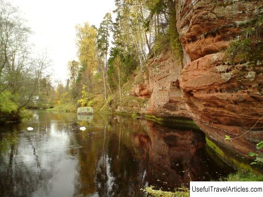
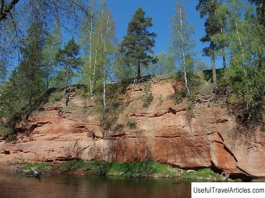
Geological outcrops of Devonian and Ordovician rocks on the Saba River description and photos - Russia - Leningrad Region: Luga District. Detailed information about the attraction. Description, photos and a map showing the nearest significant objects. Photo and descriptionGeological natural monument "Geological outcrops of Devonian and Ordovician rocks on the Saba River" was organized in 1976. It is located 3 km from the village of Osmino, near the village of Psoed. The area of the geological monument is 650 hectares. The territory of the natural monument was organized in order to protect the outcrops of geological rocks of the Ordovician and Devonian ages on the day surface, as well as preserve the remains of shell fish in Devonian deposits. The investment attractiveness of the reserve is obvious. This natural monument can be good for organizing excursions in the protected natural areas of the Luga and Gatchina regions. The Saba River Valley on the site, which begins two kilometers above the village of Psoed and ends 3.5 kilometers below the village of Osmino, has a transverse trough-shaped profile. The valley is 250-300 meters wide. The width of the river channel is 20-25 m and has a depth of 0.3-1.5 m. The river flow is calm, typical for the flat rivers of the Russian North-West. The valley has a submeridional orientation from south to north. The river bed meanders within a straight valley. Where the bedrock shores are washed away, red sandstones of Devonian age emerge on the day surface, they contain mineralized remains and imprints of fossil shell fish. The general occurrence of the layers is close to horizontal, in some horizons there is a clear oblique bedding. The outcrops rise above the waterline by 1-6 m, sometimes 12-15 m. The length of the outcrops ranges from several meters to hundreds of meters (in some areas). The vegetation here is severely disturbed due to economic activity, which was a consequence of the development of this territory by humans and the proximity of settlements. The anthropogenic load on vegetation is expressed in deforestation, mainly near settlements, contamination of the territory, fires, destruction of slopes, plowing of territories along the river banks, and trampling. On the banks of the Saba, there are areas of small-leaved-deciduous forests, they are most developed on the cliffs, in particular, in the vicinity of Osmino. Of the broadleaf tree species, rough elm is most often found here, which reaches a height of at least 15 m, ash, smooth elm, oak, linden, maple are also recorded. In the herb-dwarf shrub layer, the predominant species are those associated with broadleaf tree species. Among them are snowy, oak bluegrass, yellow zelenchuk, oak starweed, lanceolate starweed, male dwarf, lily of the valley, peach-leaved bellflower, etc. Pine forests are represented by meadow pine forests recovering after fires. There are also fragments of lily of the valley pine forests. Small-leaved forests are represented by gray alder forests. Meadows occupy most of the territory of the natural monument. Low-grass meadows growing at the site of fires consist of mountain insect, cat's paw, field clover, sticky tar, heather sedge, field toad. On the left bank of the Saba near the village of Psoed in the field., Once affected by fires, meadows with common heather are noted. On such dry meadows are not uncommon: lichen deer moss and bushy lichens from the genus Cladonia. In moderately humid areas - meadows with crowded bell, black mullein, oregano and others. In wetter areas, near the water's edge, there are tall grass meadows, where Veronica long-leaved, Angelica officinalis, Basilis yellow, Sivets field and others are found. On previously mown meadows, which have now turned into fallow lands, along with fodder grasses, sour sorrel, bent bent and St. John's wort grow. In the vicinity of Osmino, a rare species of agaric agaric is noted. In addition, on the uncrowded, damp banks of the river, there are coin-like loosestrife, creeping buttercup, and amphibian mint. Coastal aquatic and aquatic vegetation is represented by river horsetail, common arrowhead, yellow plantain lump, reed, lacustrine reed, milestone, large mannik, yellow iris, straight barnacle, meadow meadowsweet and nude meadowsweet, there are also small sedge and cochurea long-leaved, a rare species of broad-leaved guardrail. On the territory of the natural monument, the following are especially protected: outcrops of the Devonian period, fossil remains of plants, animals, rare species of plants: grapebill, mountain bukashnik, Finnish thistle. Construction, mining and reclamation work, the laying of any communications, plowing of land, littering of the territory are prohibited here.       We also recommend reading Military cemetery description and photos - Belarus: Grodno Topic: Geological outcrops of Devonian and Ordovician rocks on the Saba river description and photo - Russia - Leningrad region: Luga district. |