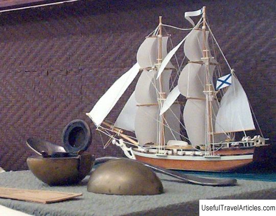
Kola superdeep well description and photo - Russia - North-West: Murmansk region
Rating: 8,2/10 (4343 votes) 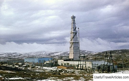
Kola superdeep well description and photos - Russia - North-West: Murmansk region. Detailed information about the attraction. Description, photos and a map showing the nearest significant objects. Photo and descriptionThe famous Kola superdeep well is the deepest in the world. It is located in the Murmansk region, namely, 10 km west of the city of Zapolyarny, in the area of the Baltic geological shield. The deepest well is 12 kilometers 262 meters. The main difference between the Kola well and others is that it was intended only for the study of the lithosphere in the area where the Morokhovichich border, close to the earth's surface, passes nearby. It is known that in 2008 the Kola well was recognized as the longest, but it was bypassed by one of the oil wells with a length of 12,290 m. In addition, in the winter of 2011, this well was bypassed by another oil well, the length of which was 12345 m. The well was laid in 1970, which was timed to coincide with the 100th anniversary of Lenin's birth. At that time, sedimentary rock formations were well studied, which was used in oil production. The most interesting thing was that some of the volcanic rocks were 3 billion years old. During the work, the geological expedition identified a place where a well could be drilled, and therefore in the spring of May 24, 1970, the first work in this direction took place. During the work, obstacles arose, but they were all overcome. In 1983, the well was drilled to a depth of 12,066 m, after which the work was temporarily stopped. In the fall of 1984, all unfinished works were resumed again. During the drilling process, a major accident occurred - the drill string was completely cut off, after which drilling was started from a depth of 7000 m. By 1990, a depth of 12262 m was reached, after which the string broke off again and drilling stopped again. During the drilling operations, the equipment Uralmash-4E, Uralmash-15000, conventional drill strings consisting of hard alloy were used. Initially, it was assumed that a distinct boundary between basalts and granites would be visible, but nevertheless, only granite rocks were found, which were largely deformed due to high pressure, changing not only physical, but also acoustic properties. During the work of experienced researchers, 12 levels were identified, which significantly differed from each other in their physical properties. The deepest levels were more homogeneous, which made it possible to assume a relatively high tectonic activity of all layers at the middle levels. In the course of the work, a lot of surprisingly valuable information regarding the earth's interior was revealed, and all the results obtained were quite unexpected, which caused some misunderstanding of the nature of the earth's mantle, as well as the essence of the formation of the surface of Mohorovichich. It is known that at a depth of 5 km the temperature of the surrounding earth exceeded 70 ° C, at a depth of 7 km - 120 ° C, and at a depth of 12 km a temperature of 220 ° C was recorded. It also became clear the fact that the well location was not chosen so well. This was expressed, first of all, in the fact that due to the geological structure of the selected area, at great depths there were rocks that, with a more correct direction of drilling, would have been revealed that did not work out in the designated place. The most valuable soil was raised from a depth of 1.5 km, where a copper ore horizon was discovered, which was very useful in the process of work. The core raised from 3 km of depth was very similar in composition to the lunar soil. In addition, at a depth of 10 km, signs of gold content were found, the amount of which per 1 ton of rock was 1 gram, but the extraction of valuable metal at such a depth is inappropriate. Today, experts and scientists Scientifically -production association "Kola Superdeep Well" is actively engaged in a detailed study of various issues of a seismic nature, because the data accumulated during the work will be enough for a long time. At the moment, the Kola well is inoperative and completely abandoned, which happened in autumn 2009.     We also recommend reading Ethnographic complex ”Belorusskaya Derevnya” description and photo - Belarus: Mogilev Topic: Kola superdeep well description and photo - Russia - North-West: Murmansk region. |