DniproHES description and photo - Ukraine: Zaporozhye
Rating: 8,2/10 (1001 votes) 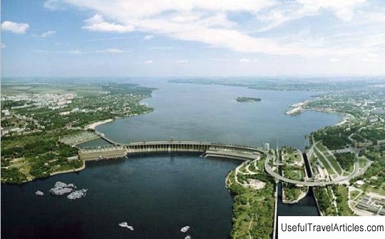
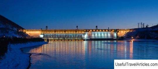
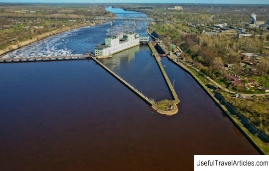
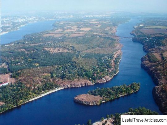
DniproHES description and photo - Ukraine: Zaporozhye. Detailed information about the attraction. Description, photos and a map showing the nearest significant objects. Photo and descriptionDniproHES is a unique hydraulic engineering structure. This is the very first hydroelectric power plant in the Soviet Union, at that time it was also the largest in Europe. The hydroelectric power plant is located on the banks of the Dnieper River, near the city of Zaporozhye, slightly below the rapids of the Dnieper. It is the fifth and oldest stage of the cascade of hydroelectric power stations on this river. The project of the station was developed by Aleksandrov I. G. Aleksandrov began to develop his project in 1920. On the rapids of the Dnieper River, he proposed to create, instead of several stations of small capacity, one rather large dam with a hydroelectric power station with a capacity of 560 MW, which was simply huge for that time. DniproHES was one of the most important objects of the GOERLO plan. Trotsky L.D. was at the head of the construction commission. and he also led the initial implementation of the project. Construction of the hydropower plant began in 1927, and the very first unit was launched in 1932. On October 10, 1932, the grand opening of the hydroelectric power station took place. Already in 1939, the planned capacity of 560 MW was reached. This hydroelectric power station became a kind of school for all Soviet power engineers. The hydroelectric power station consists of: the building of the hydroelectric power station itself, about 236 m long and about 70 m wide, which is located on the right bank of the river with a turbine room and nine vertical hydraulic units along 72 MW; then there is a shield wall 216 m long and there you can see a curvilinear spillway dam, the length of which is 760 m along the ridge, and a blind dam, 251 m long along the ridge.On the left bank there are navigable structures, which include an outport, three-chamber gateway, downstream approach channel. The hydroelectric power station itself is fully automated and equipped with telecontrol, tele-signaling and telemetry equipment.        We also recommend reading Russian Church of Bari (Chiesa Russa di Bari) description and photos - Italy: Bari Topic: DniproHES description and photo - Ukraine: Zaporozhye. |