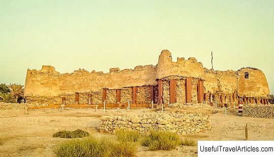
The ruins of the fortress Qal'at al-Bahrain (Qal'at al-Bahrain) description and photos - Bahrain
Rating: 8,1/10 (1342 votes) 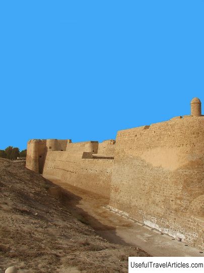
Ruins of Qal'at al-Bahrain fortress description and photos - Bahrain. Detailed information about the attraction. Description, photographs and a map showing the nearest significant objects. The name in English is Qal'at al-Bahrain. Photo and descriptionQalat al-Bahrain - the capital of Dilmun, one of the most important ancient civilizations of Eastern Arabia, is located on the northern coast of Bahrain, five kilometers west of Manama. Qalat al-Bahrain is a hill created by many layers of soil over a huge period of human activity. Its depth and height testify to the constant presence of man in these places since 2300 BC. until the 16th century AD. To date, about a quarter of the area has been excavated, revealing structures of various types of buildings: residential, public, commercial, religious and military. At the top of the 12-meter embankment is an imposing Portuguese fort that gave the name to the entire citadel. The palm groves surrounding the area have become part of the landscape, which has hardly changed since the third century BC. Excavations in these places began in the middle of the 20th century. The architectural ruins of successive civilizations speak of the importance of the city as a checkpoint on the way to Arabia and a port on the shores of the Persian Gulf. Six civilizational layers are defined in the mound. The earliest is the Dilmun village by the sea, surrounded by a stone wall. It dates back to around 2300 BC. Following 12 meters in depth, archaeologists discovered a wide street with monumental structures, including a palace dating from 2200-1800 BC. These buildings were expanded in the middle of the Bronze Age (1450-1300 BC) by the colonizers from Mesopotamia, who turned them into a palace. Another village built in this layer in the Iron Age, from about the 11th to the 5th century BC it became part of the luxurious residences and sanitary system. The monumental temple with two columns dates back to the same period. In the densely built up fifth layer, Greek ceramics and glass were discovered. This period dates back to the Greek occupation of Dilmun in the third century BC. e., at the same time the area began to be called Tilos. The upper layer begins in the Islamic period of the 14th century, when Tilos was renamed, and includes rows of dense urban development and caravanserai-type buildings. In 1561, Portuguese colonists added bastions to the hilltop fortress. The fort, overlooking the petrified coral reefs, has cut a sea channel that would have allowed access to the harbor. This allowed the citadel of Qal'at al-Bahrain to remain an important trading port for centuries. Qal'at al-Bahrain is the most famous example of the Dilmun civilization, it has been called the `` land of the living '' in the Sumerian creation myth, described as paradise in the epic of Gilgamesh. Excavation sites in 2005. included in the list of cultural heritage sites protected by UNESCO.     We also recommend reading Spassky Cathedral of the Spaso-Prilutsky Monastery description and photos - Russia - North-West: Vologda Topic: The ruins of the fortress Qal'at al-Bahrain (Qal'at al-Bahrain) description and photos - Bahrain. |