The Tasman Bridge description and photos - Australia: Hobart (Tasmania)
Rating: 8,3/10 (280 votes) 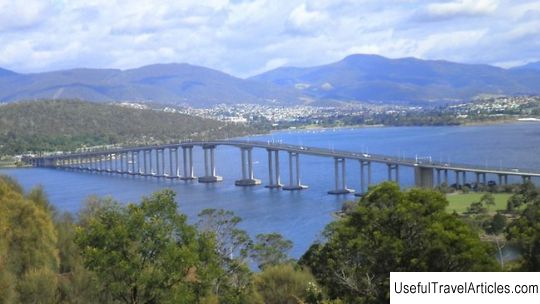
The Tasman Bridge description and photos - Australia: Hobart (Tasmania). Detailed information about the attraction. Description, photographs and a map showing the nearest significant objects. The title in English is The Tasman Bridge. Photo & DescriptionThe Tasman Bridge is a five-lane bridge across the Derwent River near downtown Hobart. The total length of the bridge is 1395 meters. Today it is the main transport artery connecting the city's business center on the west bank with the east coast, where, among other things, Hobart International Airport and the Bellerive Sports Stadium are located. There are pedestrian paths across the bridge in both directions, but there are no bicycle paths. In the 1950s, the rapid development of the eastern bank of the Derwent River raised the question of building a new bridge, as the old one could no longer cope with the increased traffic. Construction began in May 1960 and was completed in December 1964, but the bridge did not officially open until three months later, in the presence of His Royal Highness Prince Richard. Duke of Gloucester. On January 5, 1975, the Lake Illawarra ore carrier, carrying 10 thousand tons of zinc concentrate, crashed into the Tasman Bridge. As a result, two pylons and three sections of concrete flooring collapsed from the bridge and sunk the ship. Seven crew members and five motorists who were driving across the bridge were killed. The sunken ore carrier still lies at the bottom of the river. For almost a year, the Tasmanian Bridge was closed for repairs, and residents of the eastern bank traveled to the western one via the bypass bridge, which lies 50 kilometers from Hobart, or by ferry. Today, for safety reasons, road traffic on the bridge is stopped when a large ship passes under it.      We also recommend reading Porta del Mare Bastion description and photos - North Cyprus: Famagusta Topic: The Tasman Bridge description and photos - Australia: Hobart (Tasmania). |
