Uluru - Kata Tjuta National Park description and photos - Australia: Uluru / Ayers Rock
Rating: 8,2/10 (3938 votes) 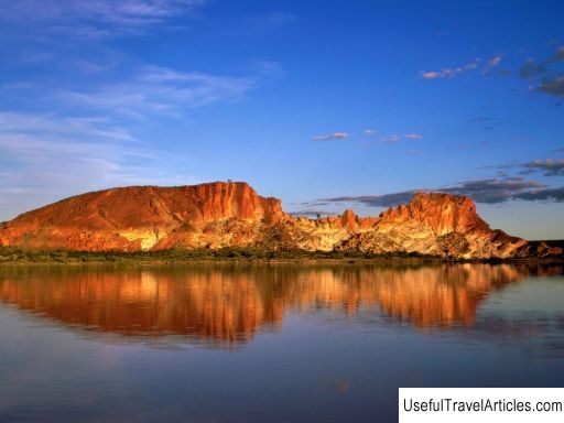
Uluru - Kata Tjuta National Park description and photos - Australia: Uluru / Ayers Rock. Detailed information about the attraction. Description, photographs and a map showing the nearest significant objects. The name in English is Uluru - Kata Tjuta National Park. Photo and descriptionUluru - Kata Tjuta National Park is located 440 km southwest of Alice Springs. The territory of the park, included in the list of UNESCO World Heritage Sites in 1987, covers an area of 2010 square kilometers. and includes the famous mountain Uluru, or Ayers Rock, and the mountains Olga, or Kata Tjuta. Uluru Rock is perhaps the most recognizable symbol of Australia, its icon and sacred place for all Australian aborigines. The world famous sandstone monolith rises 348 meters. Kata Tjuta is a sacred place for men, very strong and dangerous, which can only be entered by those who have passed the initiation ceremony. The mountain consists of 36 rocks that are over 500 million years old. The indigenous inhabitants of these places are the aborigines of the Anangu tribe, who believe that their culture was created at the beginning of time. It is the Anangu people who conduct tours around the territory of the national park, during which they talk about the flora and fauna of these places and about the history of the creation of the world. The park is jointly managed by the Aboriginal community and the Northern Territories State Parks and Wildlife Service. And the main task of such joint work is to preserve the cultural heritage of the Anangu Aborigines and the fragile ecosystem in and around the park. Interestingly, UNESCO recognizes both the cultural and natural significance of the park. In 1995, Uluru-Kata-Tjuta received the Picasso Gold Medal, the highest UNESCO award for outstanding efforts to protect the park's landscapes and Anangu Aboriginal culture. Europeans first came to these places in the 1870s during an expedition to build the Overland Telegraph Line - it was then that Uluru and Kata Tjuta were mapped. In 1872, explorer Ernest Giles saw Kata Tjuta near Royal Canyon and named it Mount Olga, and a year later another explorer Gross saw Uluru, named Ayers Rock, after Henry Ayers, the secretary general of South Australia. At the end of the 19th century, Europeans tried to develop agriculture in these places, which led to fierce clashes with the aboriginal population of the territory. Only in 1920, part of the current park was declared a reserve for the aborigines, and in 1936 the first tourists appeared here - it was the development of tourism that became the reason for the Europeans to firmly establish themselves near Uluru in the 1940s. Today Uluru and Kata Tjuta attract hundreds of thousands of tourists every year. In the late 1970s, it was decided to move all the infrastructure outside the park, and in 1975, the Yulara resort and a small airport were built 15 km from Uluru. Many routes have been laid through the park itself. For example, the Main Trail is the best way to see the great Uluru. The Valley of the Winds trail leads to Mount Kata Tjuta. It has two observation platforms with incredible views. In the Cultural Center you can get acquainted with the history, art, life and traditions of the Anangu and Tyakurpa tribes, as well as buy handmade souvenirs.   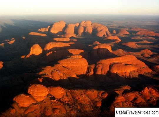      We also recommend reading Taj Mahal description and photos - India: Agra Topic: Uluru - Kata Tjuta National Park description and photos - Australia: Uluru / Ayers Rock. |
