Venetian lagoon (Laguna di Venezia) description and photos - Italy: Adriatic Riviera
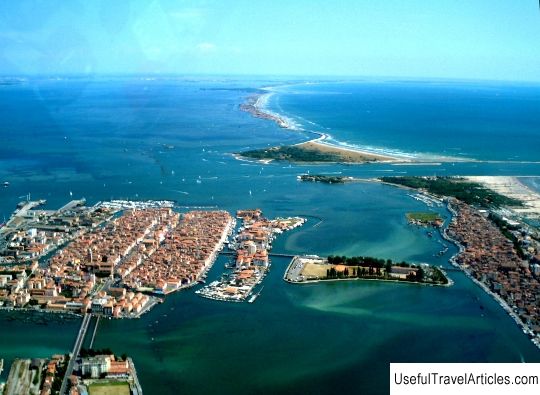
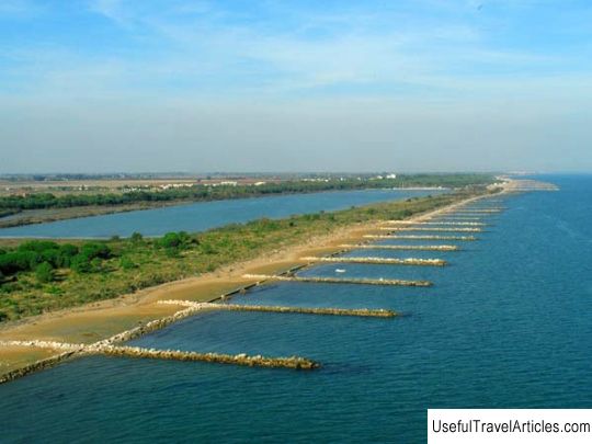
Venetian lagoon (Laguna di Venezia) description and photos - Italy: Adriatic Riviera. Detailed information about the attraction. Description, photographs and a map showing the nearest significant objects. The title in English is Laguna di Venezia. Photo and descriptionThe Venetian lagoon is geographically a closed bay of the Adriatic Sea, on the shores of which is Venice. It stretches from the Sile River in the north to Brenta in the south. The total area of the lagoon is approximately 550 sq. Km. About 8% of the lagoon's territory is occupied by small islands and, in fact, Venice, and 11% is constantly covered with water. The remaining, large, part of the lagoon - about 80% - is silted plains (so-called watts), tidal shallow waters and salt marshes. The entire Venetian lagoon is the largest wetland in the Mediterranean basin. The lagoon is connected to the Adriatic Sea by three small narrow bays - Lido, Malamocco and Chioggia. In spring, the water level in the lagoon rises significantly, causing floods that regularly flood Venice, - this phenomenon in the Italian language is called "aqua alta" (high water). The Venetian lagoon is also the most important surviving part of the entire estuarine lagoon system, which stretched from Ravenna to Trieste during the Roman era. It was on its banks in the 6th century that the Romans took refuge from the warlike Huns. Later, the geographical location of the lagoon contributed to the formation and flourishing of the powerful Venetian Republic, whose possessions stretched far beyond the Adriatic Sea. And today on the coast of the Venetian lagoon there is a large seaport and the Venetian arsenal (dock), and in recent years fish farming has developed. I must say that the Venetian lagoon itself was formed 6-7 thousand years ago, when, as a result of the advance of the sea on land after the Ice Age, part of the Adriatic coastal plain was flooded. River sediments gradually "compensated" for the land disappeared under the water, and sediments brought from the mouth of the Po river created sandbanks. The current appearance of the lagoon is the result of human activity. In the 15th and 16th centuries, various hydraulic designs by the Venetians to prevent the lagoon from becoming a swamp completely changed its natural evolution. Experiments with the aquifer, which began in the 19th century, increased subsidence. Initially, most of the islands in the lagoon were swampy, but successive drainage projects have made them habitable. Some of the smallest islets are completely artificial (including the area around the seaport of Mestre). The rest, in fact, are dunes - the coastal strip of Lido, Pellestrina and Treporti. The largest islands in the Venetian lagoon are Venice, Sant Erasmo, Murano, Chioggia, Giudecca, Mazzorbo, Torcello, Sant Elena, La Certosa, Burano, Tronchetto, Sacca Fizola, San Michele, Sacca Sessola and Santa Cristina.       We also recommend reading Banpo Bridge description and photos - South Korea: Seoul Topic: Venetian lagoon (Laguna di Venezia) description and photos - Italy: Adriatic Riviera. |