Kazantip Peninsula description and photo - Crimea: Shelkino
Rating: 8,6/10 (324 votes) 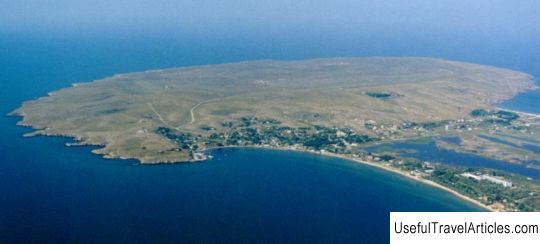
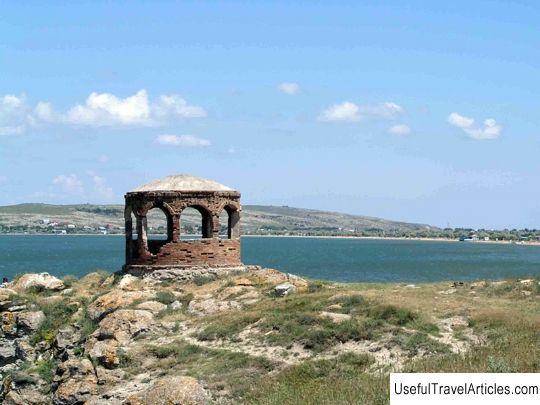
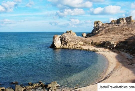
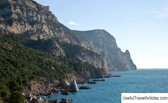
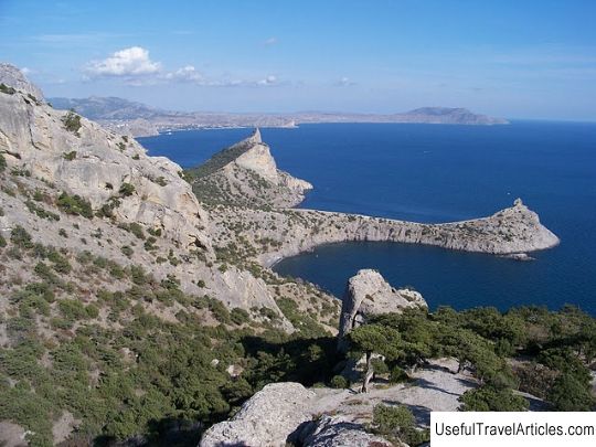
Kazantip peninsula description and photo - Crimea: Shchelkino. Detailed information about the attraction. Description, photos and a map showing the nearest significant objects. Photo and descriptionKazantip is located on the summit of the land ledge of the Kerch Peninsula, the shores of which are washed by the Sea of Azov. Kazantip and Arabat bays are located on the territory of this ledge. The Kazantip Peninsula has the shape of an ellipse in its geographic outline, the longitudinal axis of which is lengthened from the south-west to the north-east by 4.5 km, and the transverse axis is elongated from the south-east to the north-west for 2.5 km. The insular upland of the cape itself was formed as a result of an anticlinal uplift, and along the contour of the cape there is an ancient bryozoan reef, on the underwater slopes of which colonies of sea animals have long settled. The inner basin of the peninsula is surrounded by an elliptical limestone ridge. The basin itself is located in the place of the fold core, which was formed by layers of clay, shell limestone and marl. The peninsula also got its name from the central hollow, translated from Turkic as “cauldron on a hill” (“cauldron” - cauldron and tyup - “bottom of the cauldron”). The Kazantip coastline is covered with small "cuts". The very natural location of Kazantip is very original: the southern part is connected by a low and wide two-kilometer isthmus, and behind it, a little to the south, there is a similar hill on which the city of Shelkino was erected. The low-lying part of the peninsula seems to be specially created for water sports activities. The western and eastern part of the cape is covered with sandy beaches and is open for wind-driven entertainment. Kazantip is home to kiting, windsurfing and other water activities. The Kazantip Peninsula is unique not only from a geographical point of view, but also from a zoological and botanical point of view. The coast offers an amazing view of the coves (Laska, Teplaya, Shirokaya), rocks (Camel, Rider) and capes (Dolgiy, White stone, Orel). The gentle coast allows the coastal waters to warm up quickly enough, at the beginning In May, the beach season is already opening, this is almost a month earlier than on the Black Sea. And in terms of the number of sunny days per year, Kazantip is 10 days higher than similar indicators in the resorts of the southern coast of Crimea. Old-timers claim that there are many underwater caves below the water level, some of them lead to an underground passage, which stretches for several kilometers to the opposite Cape Chegen. On the territory of Mysovoye, in the immediate vicinity of the Kazantip nature reserve, there is an archaeological monument "Settlement", the date of construction of the I-III century AD. On the southeastern side of the peninsula, also outside the reserve, there is an antique ash-pan that has not yet been developed by archaeologists. In the protected area itself, on the eastern side, the Shelkovitsa bay, there is an excavation of a settlement dated to the 2nd century. BC       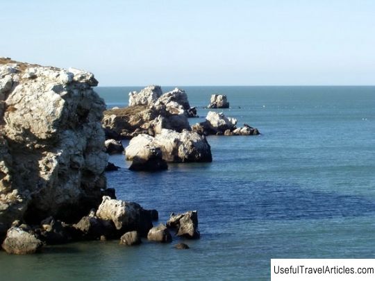   We also recommend reading White bridges waterfall description and photos - Russia - Karelia: Pitkyaranta district Topic: Kazantip Peninsula description and photo - Crimea: Shelkino. |