Valdai Upland description and photos - Russia - North-West: Valdai
Rating: 8,1/10 (1012 votes) 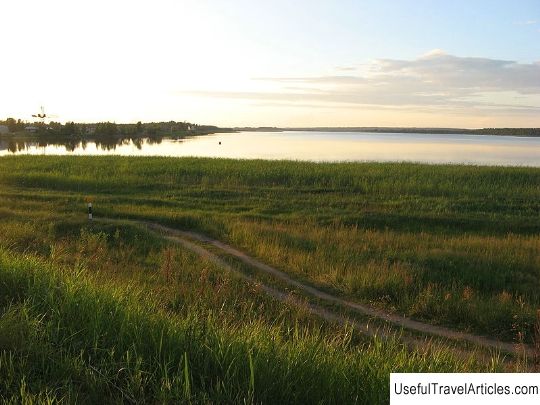
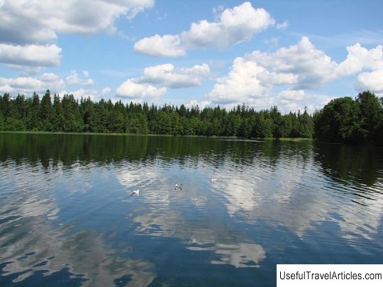
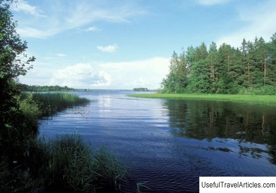
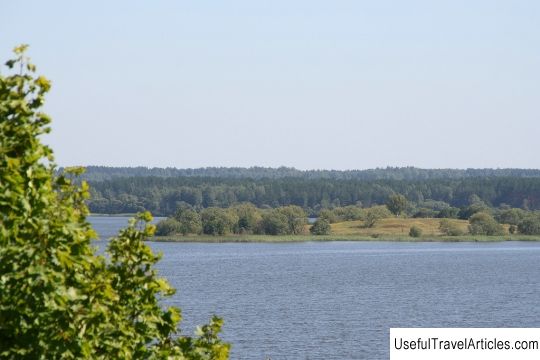
Valdai Upland description and photos - Russia - North-West: Valdai. Detailed information about the attraction. Description, photos and a map showing the nearest significant objects. Photo and descriptionThe Valdai Upland, sometimes just Valdai, is located in the northwest of the Russian Plain, within the Novgorod, Tver, Smolensk and partly Leningrad and Pskov regions. Its length is more than 600 km, the height is 150-250 m, the highest point is 346.9 m. Valdai is very popular among tourists. There are 2 national parks here: Valdai and Sebezhsky and 2 reserves: Rdeisky and Polistovsky. The Megorskaya, Tikhvin ridge, Vepsovskaya Upland and others are usually considered a part of the Valdai Upland. The Veps Upland is often called the Veppskoy. Its height is up to 304 m. The relief is hilly-moraine, there are many lakes. The main rivers of the Vepsovskaya Upland include Shoksha, Oyat, Kapshu, Pasha, Tutoka and Yavosma. At the base of the Valdai Upland, bedrocks (marls, coal limestones, clays) lie, which make up the northwestern wing of the Moscow syneclise. The rocks are overlain by water-glacial and glacial deposits. The northwestern slope of the Valdai Upland is steep and is called the Valdai-Onega scarp, the southeastern slope is gentle. The relief is moraine, hilly-ridge. The upland is rich in lakes: Lake Seliger, Upper Volga lakes (Vselug, Peno, Volgo) and others. In addition, it is characterized by strong swampiness. The highest point of the hill, by the way, of the entire Russian Plain, is often called the Makushka Valdai. Its height is 346.9 m. It runs along the top of the watershed between 2 seas: Caspian and Baltic and is located in the Vyshnevolotsky district of the Tver region, 1 km from the border with the Firovsky district and 4 km from the border with Kuvshinovsky. The nearest settlement is the village of Pochinok, Firovsky district, located 2.5 km from the summit. In the first half of the 20th century, the highest point of the Valdai Upland was set at 343 m. This information is reflected in the TSB, Soviet geographical maps and textbooks for schoolchildren. Then for some time it was believed that the highest elevation of Valdai is 346.5 m above sea level, where the geodetic point is located. The exact information about who and in what year it was built has not survived, but, according to local residents, it was installed in 1939 by German topographers. It was discovered in 1997 by the Vyshnevolotsk researcher V.A. Spansky. This point appears in modern geographical atlases and maps. In 1997-2001, a group of schoolchildren from the Yessenovichi school together with their teacher N.A. Bragin conducted research work, according to the results of which it was found that the point with a height of 346.5 m, at which the geodetic point is located, is not the highest. They found that the top of the Valdai Upland is located 60 m from the geopoint, and its height is 346.9 m above sea level. One of the research participants, a former school student S. Ivanov, was awarded at the All-Russian Olympiad based on the results of his work. The watershed of the Volga River basin and the Baltic Sea runs along the Valdai Upland. Rivers originate from Valday: Volga, Dnepr, Western Dvina, Msta, Lovat, Pola, Mologa, Syas, Tvertsa and others. The natural ecosystem of Valdai is represented by taiga-deciduous forests, in which pine, spruce, mountain ash, aspen, birch, oak are found. Moreover, mainly conifers prevail, and in the south - mixed. Nature is under the protection of the Central Forest Reserve and the Valdai National Park. Picturesque banks of rivers and lakes are especially attractive for tourists. The most popular water routes, including the famous "Upper Volga Around the World".          We also recommend reading Monument of devotion description and photo - Russia - Volga region: Togliatti Topic: Valdai Upland description and photos - Russia - North-West: Valdai. |