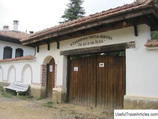
Ruins of the Hisarlik fortress description and photos - Bulgaria: Kyustendil
Rating: 7,8/10 (865 votes) 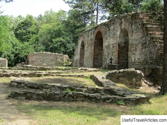
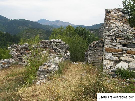
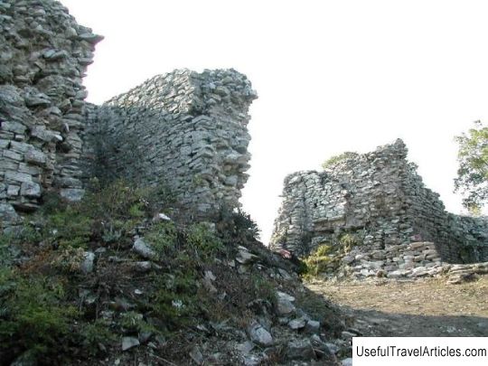
Ruins of the Hisarlyk fortress description and photos - Bulgaria: Kyustendil. Detailed information about the attraction. Description, photos and a map showing the nearest significant objects. Photo and descriptionThe ruins of the Hisarlik fortress are located on the flat part of the hill of the same name, its highest point. The Bulgarian town of Kyustendil is located two kilometers from here. The fortress was erected at the turn of the 4-5 centuries, survived both Bulgarian kingdoms and was destroyed by the Ottomans in the 15th century. The fortress was located on a fortified territory of about two hectares, in shape it is an irregular polygon, which is elongated in the direction from southeast to northwest. The average size of the building is 175 by 117 meters. The shape and location of the defensive structure does not coincide with the classical principles of fortification, in this case the structure follows the configuration of the earth's surface. On the square of the Hisarlik fortress there were fourteen towers of various shapes - rectangular, triangular and round, located in different sectors of the fortified wall, four gates and five piers - underground passages. The main gate was the eastern gate, the widest one overlooking the main path. All underground passages were located very close to the towers for strategic reasons. Each narrow passage, suitable only for pedestrians, is equipped with a granite threshold and a horizontal beam to lock the door from the inside. The width of the outer wall of the Hisarlik fortress varies from a little over one and a half meters to three, depending on the landscape - at the steepest point, the western wall is the narrowest - only 1.6 meters. According to the assumptions of archaeologists, the average height of the wall is about 10 meters, and the towers are 12. During the excavations, various periods of the construction of the Hisarlik fortress were established, which are directly related to the time of its use. The ancient chronicler Procopius of Caesarea left references to the first and most significant changes under Justinian I, the Byzantine emperor, in the 6th century. The fortress was used incessantly and for a long time in the ancient period and the Middle Ages, as evidenced by a variety of numerous finds at the site of excavation of fortress ruins. Hisarlik Fortress is an architectural and cultural monument, included in the list of objects of national importance.      We also recommend reading The convent of Lazarists description and photos - Greece: Kavala Topic: Ruins of the Hisarlik fortress description and photos - Bulgaria: Kyustendil. |